| Maps > Globes & Multi-Continent > Northern Hemisphere |
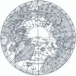 |
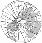
Region Around the North Pole, 1865-1898 Map of Region Around the North Pole. |
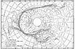 |
Cyclonic Areas, 1878-1887 Average tracks of cyclonic areas, by months and seasons, over the Northern Hemisphere, from 1878-1887. |
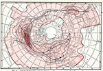 |
Cyclone Frequency, 1878-1887 Cyclone frequency over the Northern Hemispherein 1878-1887 |
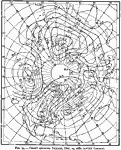 |
Isobars on December 15, 1882, December 15, 1882 Chart showing isobars on December 15, 1882. |
 |
Magnetic Meridians in Northerrn Hemisphere, 1888 Shows the lines of magnetic force from the North Pole region thru the Northern Hemisphere. |
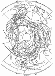 |
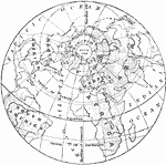
Paths of Cyclones, 1896 Paths of numerous cyclones in the Northern Hemisphere. |
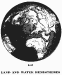 |
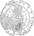
Northern hemisphere, 1909 A map of the Northern hemisphere, sometimes referred to as the "land hemisphere". |
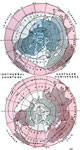 |
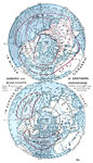
Isothermal Charts of the Northern Hemisphere, 1909 Northern Hemisphere regions of similar temperatures are shown for January and July. |
 |
Isobaric and Wind Charts of Northern Hemishpere, 1909 Illustrates wind patterns and directions as well as pressure patterns in the Northern Hemisphere during January and July. |
 |
View from the North Pole, 1910 A map looking down on the north pole, to show how the meridians come to a point at the north pole. Notice that if the 0 meridian were continued, it would unite with the meridian 180. |
 |
Northern Hemisphere, 1919 Nearly half of this hemisphere is land. |
| Maps > Globes & Multi-Continent > Northern Hemisphere |
Maps is a part of the Educational Technology Clearinghouse
Produced by the Florida Center for Instructional Technology © 2007
College of Education, University of South Florida