| Maps > North America > Mexico |
 |
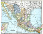
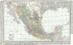
Mexico, 1902 Map of Mexico. |
 |
Map of Mexico, 1902 Map of Mexico. |
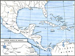 |
Cortes' March to Mexico, 1492-1620 AD Map shows Cortes' March to Mexico. |
 |
Mexico City and Vicinity, 1580 AD An early map of Mexico City and the surrounding area. |
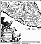 |
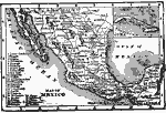
Clavigero's Map of Mexico, 1580 AD A map of Mexico's western coast from 1580. |
 |
General Plan of Mitla, 1644 AD A, the ruins on the highest ground, with a church and curacy built into the walls. B, C, and E are ruins outside the village. D is within the modern village. F is beyond the river. |
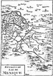 |
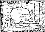
The Lake of Mexico, 1722 AD A 1722 map of the lake surrounding Mexico City. |
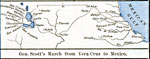 |
The Mexican War - Gen. Scott's March from Vera Cruz to Mexico, 1846-1848 AD One of four maps on this page illustrating the Mexican War. This map shows the path taken by Gen. Scott from Vera Cruz to Mexico City. |
 |
Route of the US Army in the Mexican-American War, 1846-1848 AD A map showing the route of the US Army from Vera Cruz to Mexico City during the Mexican-American War. |
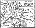 |
Vicinity of Mexico, 1847 A map showing the vicinity of Mexico. |
 |
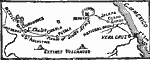
Northeast Mexico, 1847 AD A map showing the northern Gulf coast of Mexico, where several battles of the Mexican War were fought. |
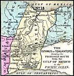 |
Map of the Isthmus of Tehuantepec, 1852 AD Map of the Isthmus of Tehuantepec in Mexico showing a proposed route for a canal connecting the Gulf of Mexico and the Pacific. |
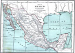 |
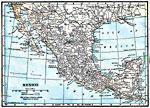
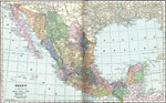
Mexico, 1870 AD A map showing the country of Mexico. |
 |
Mexico, 1872 AD Physical map of Mexico, with a map insert providing principal products and seaports of Mexico and the West Indies. Includes water routes and currents, select elevations, and latitude and temperature comparisons to other countries. Time zones are given. |
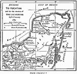 |
The Yucatan, 1882 AD A map of the Yucatan peninsula. |
 |
Mexico, 1885 AD Mexico, showing completed and unfinished railroads. |
 |
Mexico, 1906 AD Map of Mexico in 1906. |
 |
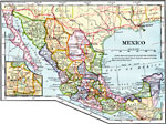
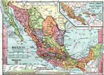
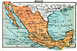
Mexico, 1911 This is an early 20th century map of Mexico and its 31 states. The inset map is of the 3 states on the Yucatan peninsula. |
 |
Mexico, 1912 Map of Mexico showing waterways, mountain ranges, cities, railroads, and projected railroads. |
 |
Mexico, 1916 AD Mexico, showing railroads and projected railroads. |
 |
Mexico, 1919 AD A map of Mexico in 1919, showing cities and railway routes. |
 |
Mexico, 1920 The country of Mexico. |
 |
Mexico, 1920 Map of Mexico. |
 |
Mexico, 1920 Physical map of Mexico with railroads. |
| Maps > North America > Mexico |
Maps is a part of the Educational Technology Clearinghouse
Produced by the Florida Center for Instructional Technology © 2007
College of Education, University of South Florida