| Maps > United States > California |
 |
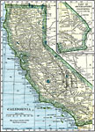
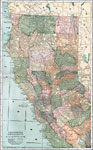
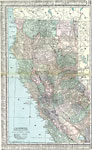
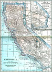
Map of California, Map of California. |
 |
Geomorphic Map of California, A geomorphic map of California, showing the diastrophic character of the relief and the most important known faults. |
 |
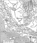
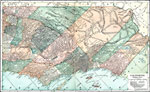
Bear Valley Region, A map, showing that Bear Valley and the adjacent country exhibit the subdued relief characteristic of the interior of the San Bernardino Mountains. |
 |
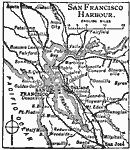
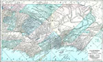
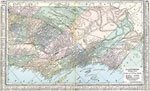
San Francisco Harbour, Map of San Francisco Harbour in California. |
 |
The Mexican War - The Golden Gate, 1846-1848 One of four maps on this page illustrating the Mexican War. This map shows the Golden Gate area of California. |
 |
The Mexican War - Mouth of the Rio Grande, 1846-1848 One of four maps on this page illustrating the Mexican War. This map shows the area around the mouth of the Rio Grande river in California. |
 |
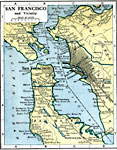
San Francisco, 1901 Map of San Francisco and its vicinity. |
 |
San Francisco, 1903 Map of the San Francisco Bay area in 1903. |
 |
California, 1906 Map of California in 1906. |
 |
San Francisco and Vicinity, 1909 A map of San Francisco and the surrounding vicinity, around 1909. |
 |
Yosemite Valley, 1911 Typical portion of Yosemite Valley, showing cliffed margins, waterfalls, flat floor, and meandering stream. |
 |
Sierra Nevada, 1911 A map showing the ranges of four characteristic species in the Northern Sierra Nevada. |
 |
Pacific Coast Valleys, 1911 Bench lands, coastal plains, and mountains of Southern California. |
 |
Relief of the California Coast, 1916 A relief map of part of the Californian coast, with elevations shown by shading. |
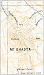 |
Mount Shasta, 1916 A map of Mt. Shasta, a volcanic mountain peak. |
 |
Contour Map of the California Coast, 1916 A relief map shown by countours of a sectino of the California coast. |
 |
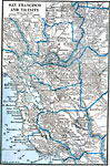
San Francisco and Vicinity, 1916 A map of San Francisco and the surrounding vicinity in 1916. |
 |
California, 1919 A map of the state of California in 1919, showing cities and railway routes. |
 |
San Francisco Harbor, 1919 A map showing San Francisco Harbor in 1919. |
 |
Northern and Central California, 1920 The northern and central parts of the state of California. |
 |
Southern California, 1920 The southern part of the state of California. |
 |
Northern and Central California, 1920 Physical map of the northern and central parts of California. Includes national parks, forests, and indian reservations. |
 |
Southern California, 1920 Physical map of the southern part of California. Includes national parks, forests, and indian reservations. |
 |
California (Northern and Central Part), 1920 Map of northern and central California. |
 |
California (Southern Part), 1920 Map of southern California. |
 |
California, Post World War I Map of California. |
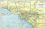 |
Los Angeles and Vicinity, Post World War I Map of Los Angeles, California and surrounding vicinity. |
 |
San Francisco and Vicinity, Post World War I Map of San Francisco, California and surrounding vicinity. |
 |
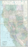
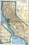
California, 1922 Physical map of California. |
 |
san Francisco and Vicinity, 1922 San Francisco and neighboring counties. |
| Maps > United States > California |
Maps is a part of the Educational Technology Clearinghouse
Produced by the Florida Center for Instructional Technology © 2007
College of Education, University of South Florida