Maps Site map
  Maps > United States > Early America 1400-1800
Site Map  

  Record   101   to   110  of   199

A collection of historic maps of early America from explorations and settlements of the English, French, and Spanish, to the end of the American Revolutionary War.

Eastern Massachusetts, 1775–1776
A map of eastern Massachusetts in 1775, showing the coastline of Massachusetts Bay, Boston, Charleston, Concord, Marshfield and other settlements, and the routes of the British expeditions to Salem, Concord, and Marshfield. An inset map details the v...

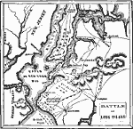
Battle of Long Island, 1775–1776
A plan of the Battle of Long Island (August 27, 1776), also known as the Battle of Brooklyn, fought between the British army under General Howe and the Americans under George Washington during the American Revolutionary War. The map shows the positio...

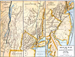
Seat of the War in the Eastern and Middle States, 1775–1780
A series of three maps showing the northern operations during the Revolutionary War. The left map details the Hudson Valley from Lake Champlain to Albany area, the middle map details Hudson Valley from Albany to Long Island, and the right map shows t...

Seat of War in the Southern States, 1775–1781
A map of parts of Virginia, North Carolina, South Carolina, and Georgia showing the seat of war in the southern states during the American Revolution. The map shows the routes of Cornwallis from Savannah to Augusta, Charleston, Guilford Court House, ...

Principal Battles of the War of Independence, 1775–1781
A sketch map of eastern North America showing the principal battle sites of the American War of Independence (1775–1781). The map gives the site names and dates of the conflicts, including the British surrender to Washington at Yorktown, Virgin...

American Revolutionary War Operations in the West, 1775–1782
A map of the Northwest Territory between the Allegheny Mountains and the Mississippi River and the Great Lakes to the Tennessee River showing the military operations and extent of settlement in the area during the American Revolutionary War. The map ...

New Settlements and Proposed Communities in the West, 1775–1782
A map of the new settlements and proposed communities in the Tennessee and Kentucky country between the Allegheny Mountains and the Ohio River, from 1775 to 1782. The map shows the proposed proprietary colony of Transylvania under Judge Richard Hende...

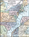
The Colonies during the Revolutionary War, 1775–1783
A map of the Thirteen Colonies during the American Revolution. The map shows the territorial claims west of the Allegheny Mountains, and includes inset maps detailing the vicinity of Philadelphia, the vicinity of Boston, and the vicinity of New York....

Routes of the British Army, 1775–1783
A series of three maps showing the routes of the British Army during the Revolutionary War. The upper left map details the Lower Hudson, Connecticut, Rhode Island, New Jersey, and Pennsylvania region, the upper right map details Lake Champlain and up...

American Revolutionary War Campaigns in the South, 1775–1783
A map of the portions of Virginia, North Carolina, South Carolina, and Georgia involved in major campaigns of the American Revolutionary War. The map shows cities, towns, and forts, rivers and terrain features, and is keyed to show British and Americ...

First Previous Next Last


  Maps > United States > Early America 1400-1800
Site Map  

Maps ETC is a part of the Educational Technology Clearinghouse
Produced by the Florida Center for Instructional Technology © 2009
College of Education, University of South Florida