|
|
|
| Maps > United States > Early America 1400-1800 |
A collection of historic maps of early America from explorations and settlements of the English, French, and Spanish, to the end of the American Revolutionary War.
|
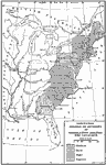
Estimated Degree of Severity of Legislation Against the Loyalists,
1777–1780 |
|
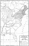
Progress of Emancipation,
1777–1804 |
|
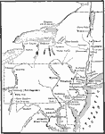
Middle Atlantic States,
1778–1779 |
|
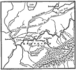
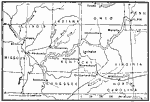
Clark's Campaign in the West,
1778–1779 |
|
Clark's Campaign in the Northwest,
1778–1779 |
|
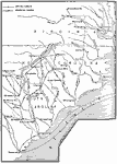
The Campaigns in the South,
1778–1779 |
|
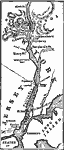
The Hudson River – Newburg to New York,
1779 |
|
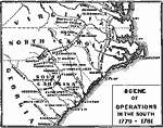
Scene of Operations in the South,
1779–1781 |
|
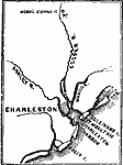
Charleston and vicinity ,
1780 |
|
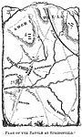
Plan of the Battle at Springfield,
1780 |
| First | Previous | Next | Last |
| Maps > United States > Early America 1400-1800 |
Maps ETC is a part of the Educational Technology Clearinghouse
Produced by the Florida Center for Instructional Technology © 2009
College of Education, University of South Florida