|
|
|
| Maps > United States > Early America 1400-1800 |
A collection of historic maps of early America from explorations and settlements of the English, French, and Spanish, to the end of the American Revolutionary War.
|
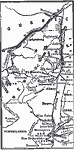
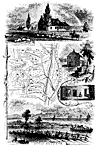
Routes of Burgoyne and St. Leger,
1777 |
|
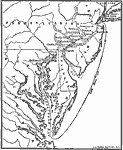
Howe's Route to Philadelphia,
1777 |
|
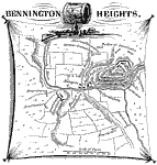
Bennington Heights,
1777 |
|
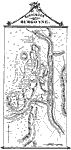
Surrender of Burgoyne,
1777 |
|
Bemis' Heights,
1777 |
|
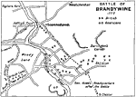
Battle of Brandywine,
1777 |
|
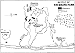
Battle of Freemans Farm,
1777 |
|
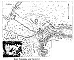
Fort Schuyler and Vicinity,
1777 |
|
The Campaigns in the Middle States,
1777–1778 |
|
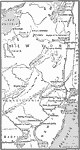
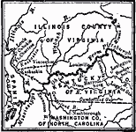
Route of George Rogers Clark,
1777–1779 |
| First | Previous | Next | Last |
| Maps > United States > Early America 1400-1800 |
Maps ETC is a part of the Educational Technology Clearinghouse
Produced by the Florida Center for Instructional Technology © 2009
College of Education, University of South Florida