Maps Site map
  Maps > United States > Early America 1400-1800
Site Map  

  Record   171   to   180  of   199

A collection of historic maps of early America from explorations and settlements of the English, French, and Spanish, to the end of the American Revolutionary War.

United States at the Close of the Revolution, 1783
A map of the United States at the close of the American Revolutionary War (1783) showing the newly formed States, and their claims to the lands west of the Allegheny Mountains to the Mississippi River. The map notes the disputed territories north of ...

The States and their Land Claims at close of Revolution, 1783
A map of the United States at the close of the American Revolutionary War showing the newly formed States, and their claims to the lands west of the Allegheny Mountains to the Mississippi River. The map shows the territories jointly claimed by the St...

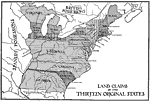
Land Claims of the Thirteen Original States, 1783
A map of eastern North America showing the land claims of the original thirteen states after the American Revolutionary War, from the Atlantic coast to the Mississippi River, as well as the boundaries of the British and Spanish possessions. State bou...

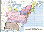
The Territory of the Thirteen Original States, 1783
A map of the United States at the close of the American Revolutionary War (1783) showing the newly formed States, and their claims to the lands west of the Allegheny Mountains to the Mississippi River....

The West, 1783–1789
A map of the early United States between 1783 and 1789 showing the territorial State claims west to the Mississippi River, and is keyed to show undefined or disputed boundaries, boundaries of States and territories, and boundaries not settled. The ma...

State Claims to Western Lands, 1783–1802
A map of the United States east of the Mississippi River showing the State claims between 1783–1802. The map shows the western territorial boundary established by the Treaty of 1783 between Britain and the United States, the State claims to the...

Early Territory of the United States, 1783–1863
A map of the early United States west of the Mississippi River, showing the original territory after the Treaty of Paris 1783, the territory northwest of the Ohio River, the territory south of the Ohio River, the Mississippi Territory ceded by Georgi...

Proposed Division of Western Lands, 1784
A map of the United States and the Northwest Territory east of the Mississippi River showing the proposed division of western lands ‘ceded or to be ceded’ by the states according to the Ordinance of April 23, 1784. Under this proposed Ord...

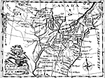
Division of States according to the Ordinance of 1784, 1784
A facsimile of a map from Francis Bailey's Pocket Almanac (1785) showing the Northwest Territory of the United States and the land divisions proposed by the Ordinance of 1784. The Ordinance of 1784 called for all land between the Mississippi River an...

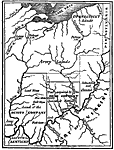
Barlow's Map, 1785
An English facsimile of a map issued by Joel Barlow in Paris (1787) of the area north of the Ohio River, showing the essential parts of a map with his proposals to induce immigration, but the legends are turned into English from the original French. ...

First Previous Next Last


  Maps > United States > Early America 1400-1800
Site Map  

Maps ETC is a part of the Educational Technology Clearinghouse
Produced by the Florida Center for Instructional Technology © 2009
College of Education, University of South Florida