|
|
|
| Maps > United States > Early America 1400-1800 |
A collection of historic maps of early America from explorations and settlements of the English, French, and Spanish, to the end of the American Revolutionary War.
|
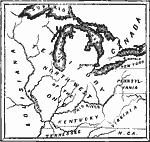
The Northwest Territory,
1787 |
|
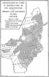
Distribution of Votes in Ratification of the Constitution,
1787–1788 |
|
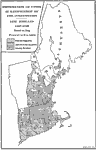
Distribution of Votes in Ratification of the Constitution in New England,
1787–1790 |
|
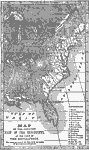
United States at the Close of the Revolution,
1789 |
|
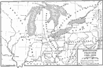
Northwest Frontier,
1789–1800 |
|
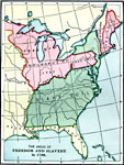
Freedom and Slavery in the Early United States,
1790 |
|
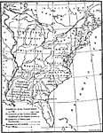
The Early United States,
1790 |
|
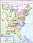
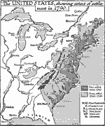
The United States,
1790 |
|
The United States,
1790 |
|
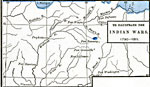
The Northwest Indian Wars,
1790–1811 |
| First | Previous | Next | Last |
| Maps > United States > Early America 1400-1800 |
Maps ETC is a part of the Educational Technology Clearinghouse
Produced by the Florida Center for Instructional Technology © 2009
College of Education, University of South Florida