| Maps > United States > New York |
 |
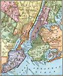
New York City, Map of New York City. |
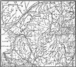 |
Adirondack Mountains, A map showing the plateau-like western portions of the Adirondack Mountains in contrast to the mountainous eastern portion. |
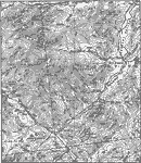 |
, A map showing the rectangular pattern of relief and drainage lines in fault-block mountains of the eastern Adirondacks. |
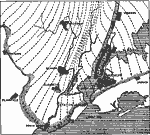 |
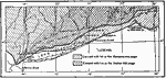
Vicinity of New York, A map showing the terminal moraine and direction of ice movement in the vicinity of New York. |
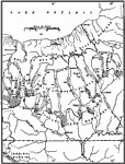 |
Physiographic Belts in Central New York, A map showing the physiographic belts in central New York. Heavy dotted line is on the divide. Figures represent elevations above sea level. |
 |
Map of Portion of New York, Map of portion of New York. 1, Ordovician; 2-5, Silurian; 6-13, Devonian; 14, Mississippian. |
 |
Glacial Lake Succession in New York State, A map of the glacial lake sucession in New York state, Lake Newberry. Note overflow southward into the Susquehanna. |
 |
Glacial Lake Succession in New York State, A map showing the glacial lake succession in New York state, Lake Hall. Overflow at this stage was westward to the Mississippi instead of southward to the Susquehanna. Elevations from 1000 feet on east to 900 feet on west. |
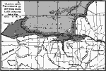 |
Glacial Lake Succession in New York State, A map showing the glacial lake succession in New York state, Lake Iroquois. Overflow eastward to the Mohawk. Elevation under 360 feet. A number of intermediate stages are omitted from this series. The three stages shown here are of chief importance. |
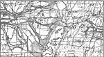 |
Ice-border Drainage, A map showing the channels and deltas of a part of the ice-border drainage between Leroy and Fishers, New York. |
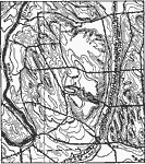 |
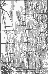
Roc Drumlins, Roc drumlins or drumloids. The drumlin-shaped forms in the upper part of map are developed on shale. |
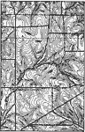 |
Cherry Creek Quadrangle, A map showing part of the Cherry Creek Quadrangle. |
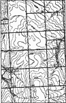 |
Ovid Quadrangle, A map showing part of the Ovid Quadrangle. |
 |
Clyde Quadrangle, A map showing part of the Clyde Quadrangle. |
 |
Canandaigua Quadrangle, A map showing part of the Cananaigua Quadrangle. |
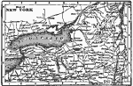 |
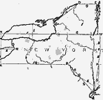
Map of New York, Map of New York. |
 |
The Environs of New York, Map of New York. |
 |
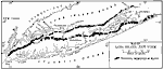
Ice During the Wisconsin Glaciation, A map showing the ice during the Wisconsin glaciation. |
 |
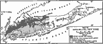
Terminal Moraines of Long Island, A map showing the terminal moraines in black. |
 |
Soils of Long Island, A map showing the soils of Long Island. |
 |
Vegetation of Long Island, A mpa showing the vegetation of Long Island. |
 |
Territory of the Five Nations about 1650, 1650 A map showing the territory of the Five Nations around 1650. |
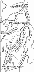 |
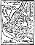
Ticonderoga, 1754-1763 A map showing the area around Ticonderoga during the French and Indian War. |
 |
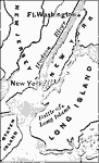
Battle of Long Island, 1776 A map showing the region around which the battle of Long Island was fought. |
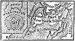 |
Forts Lee and Washington, 1776 A map showing Forts Lee and Washington in New York state. |
 |
Washington's Winter Campaign, 1776-1777 A map of Washington's campaign in the winter of 1776-1777. |
 |
The Battle of Long Island, August 17, 1776 A map showing the region around New York, where the Battle of Long Island took place. |
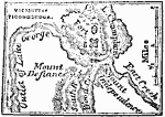 |
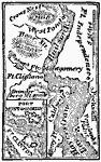
Vicinity of Ticonderoga, 1777 A map of the area around Fort Ticonderoga during the Revolutionary War. |
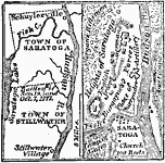 |
Town of Saratoga, 1777 A map showing the towns of Saratoga and Stillwater on one half, and the other half showing the arrangement of forces during the battle during the American Revolution. |
 |
Forts on the Hudson, 1777 A map showing forts along the Hudson River during the American Revolution. |
 |
Niagara Frontier, 1812 A map of the Niagara frontier. |
 |
Vicinity of Niagara Falls, 1814 A map showing the vicinity of Niagara Falls around 1814. |
 |
Niagara Frontier, 1815 A map of the Niagara frontier during the War of 1812. |
 |
Greater New York and vicinity, 1865-1898 Map of Greater New York and vicinity. |
 |
New York Harbor, 1872 The entrance to New York harbor, between Long Island on the east and Staten Island on the west, is called the Narrows. It is about one mile wide, and is nine miles below the city. |
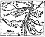 |
Albany and Vicinity, 1872 Albany, now the capital of the state of New York, is situated on the west bank of the Hudson River, 145 miles N. from New York by the river's course. |
 |
Drawing of New York, 1872 Illustrates instructions for drawing New York. |
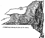 |
Relief Map of New York, 1872 Relief map of New York. |
 |
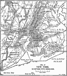
New York and Vicinity, 1872 New York City and vicinity. |
 |
Vicinity of Lake George, 1872 Fort Edward was on the site of the present village of Fort Edward, in Washington County, on the E. side of Hudson River, and about forty-five miles N. from Albany. |
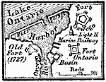 |
Forts at Oswego, 1872 The village of Oswego, in Oswego County, is situated on both sides of Oswego River, at its entrance into Lake Ontario. |
 |
Westchester County, 1872 Bronz River rises in Westchester County, near the line of Connecticut, and after a course of twenty-fives miles, nearly south, enters the Sound (or East River) a little S.W. from the village of Westchester. |
 |
Central Park, 1881 A 1881 map of Central Park, New York City. |
 |
Lake George, 1881 Lake George, caled also Horicon, a picturesque sheet of water remarkable for its transparency and for the beauty of the scenery on its shores, lies in the state of New York. |
 |
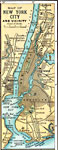
New York City Vicinity, 1883 New York City and vicinity. |
 |
New York City, 1891 A map of New York City in 1891. |
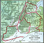 |
Greater New York, 1901 Map showing "Greater" New York and its vicinity. |
 |
Greater New York, 1903, 1903 A map of Greater New York, as it was in 1903. |
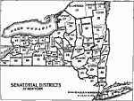 |
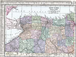
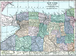
Senatorial Districts of New York, 1903 A map showing the Senatorial districts of New York in 1903. |
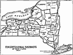 |
Congressional Districts of New York, 1903 A map showing the Congressional districts of New York state in 1903. |
 |
Congressional Map of Manhattan and Bronx, 1903 A map showing the congressional districts of Manhattan and the Bronx in 1903. |
 |
Senatorial Map of Manhattan and Bronx, 1903 A map showing the Senatorial districts of Manhattan and the Bronx in 1903. |
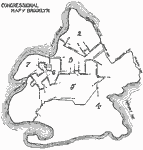 |
Congressional Map of Brooklyn, 1903 A map showing the Congressional districts of Brooklyn in 1903. |
 |
Senatorial Map of Brooklyn, 1903 A map showing the Senatorial districts of Brooklyn in 1903. |
 |
New York, 1906 Map of New York in 1906. |
 |
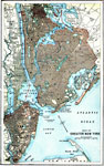
Boroughs of New York, 1909 A map of New York and its vicinity, divided into boroughs. |
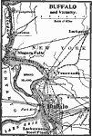 |
Buffalo and Vicinity, 1909 A map of Buffalo and its vicinity. |
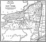 |
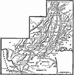
Canals of New York, 1910 A map of the canals of New York. |
 |
Buffalo, Rochester, and Albany, 1910 A map showing the locations of Buffalo, Rochester, and Albany. |
 |
New York City, 1911 A map showing part of New York City in 1911. |
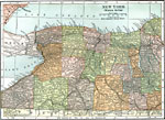 |
Western New York, 1914 The western section of New York. |
 |
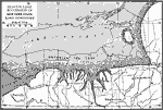
Drumlins in New York, 1916 A map showing drumlins (oval kills composed of glacial waste) in New York. |
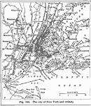 |
New York City and Vicinity, 1916 A map of the city of New York and its vicinity. |
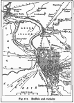 |
Buffalo and Vicinity, 1916 A map of Buffalo, New York and the surrounding vicinity in 1916. |
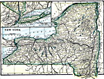 |
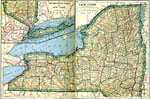
New York, 1919 A map showing New York state, with cities, railway routes, and canals. |
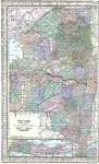 |
New York (Eastern Section), 1920 Map of the eastern half of New York. |
 |
New York (Western Section), 1920 Map of the western half of New York. |
 |
Eastern New York, 1920 Physical map of the eastern part of New York with map insert of Long Island. Includes railroads and canals. |
 |
Western New York, 1920 Physical map of the western part New York. |
 |
Eastern New York, 1920 The eastern section of New York, showing railroads and canals. |
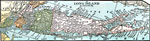 |
Long Island, New York, 1920 Long Island, New York. |
 |
New York, Post World War I Map of New York. |
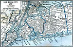 |
New York City and Vicinity, 1922 New York City and neighboring counties. |
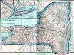 |
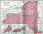
New York, 1922 Physical map of New York. |
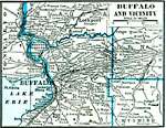 |
Buffalo and Vicinity, 1922 Buffalo and neighboring counties. |
| Maps > United States > New York |
Maps is a part of the Educational Technology Clearinghouse
Produced by the Florida Center for Instructional Technology © 2007
College of Education, University of South Florida