Maps Site map
  Maps > Europe > Regional Maps >Mediterranean Europe
Site Map  

  Record   1   to   10  of   11

Regional European maps of the Mediterranean Europe region from the Maps ETC collection. This includes physical and political maps, early history and empires, WWI maps, climate maps, relief maps, vegetation maps, population density and distribution maps, cultural maps, and economic/resource maps.
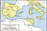
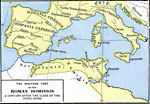
The Western Part of the Roman Dominion at the Close of the Punic Wars, 146 BC
A map of the western portion of the Roman Empire at the close of the Punic Wars in 146 BC, showing the extent of the Empire in Hispania and Gallia Cisalpina, its borders with unconquered Gallia, and its extent in northern Africa restricted to the ter...

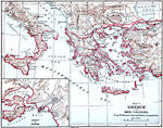
Greece and her Colonies, 1600–265 BC
A map of early Hellas and her colonies in the eastern Mediterranean region, including southern Italy and Sicily, Crete, and coastal Asia Minor. An inset map details the vicinity of Athens and Piraeus, including the long walls and city fortification....

Eastern Spain and Western Italy, 1635–1659
A map of eastern Spain, southern France, and western Italy during the Franco–Spanish War (1635–1659)....

North Italy and Switzerland, 1796–1805
A map of northern Italy and Switzerland during the Napoleonic Wars (1796–1805). The map shows terrain features, lakes, rivers, principal cities, and battle sites of the region. An inset map details the vicinity of Rivalta, Italy....

Southern Europe and Mediterranean Shore, 1888
A map from 1888 of southern Europe and the shores of the Mediterranean showing the countries of Portugal, Spain, portions of France, Switzerland, Italy, portions of Austria, Montenegro, Servia, Roumania, Greece, and Turkey in Europe. This map shows m...

Route Chart of the Mediterranean Sea, 1915
A map from 1915 of the Mediterranean Sea and Black Sea region showing steamship routes with distances between ports given in nautical miles. The map uses color–contouring to show elevations from sea level to above 6000 feet and water depths at ...

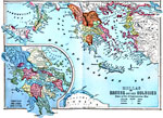
Greece and Her Colonies, 431–404 BC
A map of ancient Hellas or Greece and her colonies at the time of the Peloponnesian War (431–404 BC) between Athens and allies against the Peloponnesian League led by Sparta. The map is color–coded to show the territories of the &Aelig;ol...

The Western Part of the Roman Dominion One Century after the Close of the Punic Wars, 46 B.C.
A map of the western portion of the Roman Empire in 46 BC, a century after the close of the Punic Wars, showing the extent of the Empire across modern France and in north Africa....

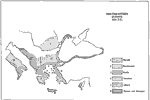
Southeastern Europe, 600 B.C.
A map of southeastern Europe in 600 B.C. showing territories and distribution of peoples, including the Dacians, Macedonians, Greeks, Thracians, Italians, and the Illyrians and Albanians. ...

Ancient Greece and Italy, 700 BC to AD 200
A sketch map of Ancient Greece and Italy showing principal cities and territories of the era. ...

Next Last


  Maps > Europe > Regional Maps >Mediterranean Europe
Site Map  

Maps is a part of the Educational Technology Clearinghouse
Produced by the Florida Center for Instructional Technology © 2009
College of Education , University of South Florida