Record
1 to
10 of
11
Regional European maps of the Miscellaneous Europe region from the Maps ETC collection. This includes physical and political maps, early history and empires, WWI maps, climate maps, relief maps, vegetation maps, population density and distribution maps, cultural maps, and economic/resource maps.

|
The Realm of Cnut the Great,
1028–1035
A map of Britain and Scandinavia showing the realm of Cnut the Great (Knut), the Viking king of England, Denmark, Norway, and parts of Sweden in 1028–1035. The map shows the German Sea (North Sea) and Baltic Sea....
|

|
West Coast of Europe,
1367–1436
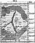
Two facsimiles of early maps of the west coast of Europe showing the Atlantic islands off the coast of Spain and North Africa. The left–hand facsimile is of the Fr. Pizigani map (1367), illustrating an early Irish monk voyage, and shows the Azo...
|
|
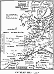
Catalan Map,
1375
A facsimile map of Europe and northwestern Africa from the Catalan Mappemonde (Atlas) of 1375.The original map is oriented to the south (which is why the flags denoting political allegiances appear to be upside down) but the facsimile and its labels ...
|
|
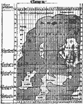
Claudius Clavus Map of Northwestern Europe,
1427
A facsimile of the 1427 map of Northwestern Europe by Claudius Clavus showing the islands of Iceland, Ireland, with Scotland and the northern portion of England and the western portion of Norway. This map also shows the eastern portion of Greenland, ...
|

|
Benincasa Chart of the Atlantic,
1476
A facsimile of a portion of the Andreas Benincasa marine chart from 1476 showing the Atlantic Coast of Europe from the Strait of Dover to the Strait of Gibraltar, and shows the British Isles, Canary Islands, Cape Verde Island, and a portion of the no...
|
|
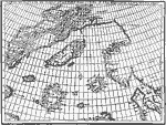
Zeno Map,
1558
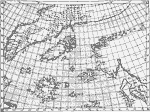
A facsimile of the Zeno map of the purported voyage of Nicolo and Antonio Zeno across the North Atlantic to North America in 1380 (generally presumed to be a hoax intended to claim discovery of the New World before Columbus). The map shows Norvegia (...
|
|
Ptolemy Alteration of the Zeno Map,
1561
A facsimile of the Zeno map of the purported voyage of Nicolo and Antonio Zeno across the North Atlantic to North America in 1380 (generally presumed to be a hoax intended to claim discovery of the New World before Columbus). The map shows Norvegia (...
|

|
North Eastern Atlantic,
1585–1604
A map of the coastal areas of the northeastern Atlantic during the Elizabethan naval wars between the Spanish and English armadas in 1585–1604. The map shows the locations of several important battles, including Cadiz near Gibralter (1587), Gra...
|

|
Map to Illustrate "The Cloister & The Hearth",
15th Century
A map to Illustrate Charles Reade's 1861 novel "The Cloister & The Hearth." This map shows Gerard's route in the 15th Century from Holland, the point at which Gerard and Denys part, and the Gerard's route to Rome after parting with Denys. M...
|
Maps
is a part of the
Educational Technology Clearinghouse
Produced by the
Florida Center for Instructional Technology
© 2009
College of Education
,
University of South Florida


