|
|
|
| Maps > Europe > United Kingdom |
A collection of historic and contemporary maps of England, Scotland, and Wales, including historic divisions, empires and kingdoms, detailed travel maps, climate maps, population density and distribution maps, vegetation maps, and economic/resource maps.
|
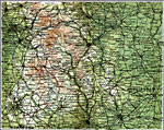
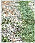
Derby and Sheffield,
1908 |
|
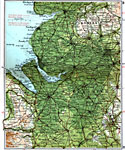
Liverpool and Manchester,
1908 |
|
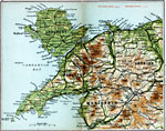
North Wales,
1908 |
|
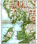
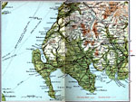
Lake District and Isle of Man,
1908 |
|
West Yorkshire,
1908 |
|
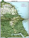
Yorkshire Coast,
1908 |
|
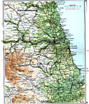
Durham and Newcastle,
1908 |
|
Carlisle and Dumfries,
1908 |
|
Wigtown and Kirkcudbright,
1908 |
|
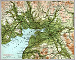
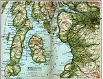
Firth of Clyde,
1908 |
| First | Previous | Next | Last |
| Maps > Europe > United Kingdom |
Maps ETC is a part of the Educational Technology Clearinghouse
Produced by the Florida Center for Instructional Technology © 2009
College of Education, University of South Florida