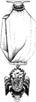
Niagra Bridge
Part of Niagra Suspension Bridge. This view, looking up from the river, comprises about one half the…
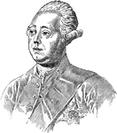
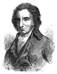
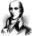
Lord North
Frederick North was the Prime Minister of Great Britain from 1770 to 1782. He led Great Britain through…
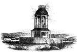
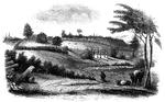
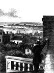
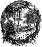
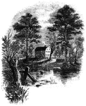
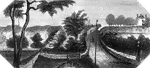
Observatory
"The observatory. This view is from the field, looking north. On the left is seen the winding Schuylkill,…
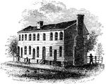
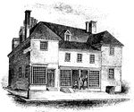
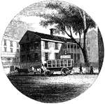
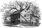
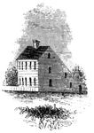
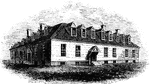
Old City Tavern
"Old City Tavern. This is a frame building, and stands on the northwest corner of Main and Nineteenth…
Old Parsonage and Church
Old Parsonage and Church. This view is from the high plain on the right of the block-house, looking…
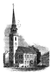
Old South
"The Old South. This venerable and venerated edifice, that stood through all the storms of the Revolution,…
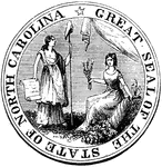
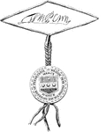
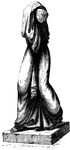
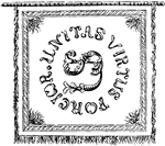
Order of the Cincinnati
"Order of the Cincinnati. This was drawn from an original in the possession of Edward Phalon, Esq.,…
Oriskany
The battle-ground of Oriskany. This sketch was made from the eastern side of the ravine, looking west.…
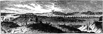
Oswego
Oswego in 1755. This view is looking north toward the lake. It is a reduced copy of the frontispiece…
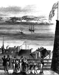
Oswego Harbor
View of Oswego Harbor, 1848. This view is from the top of the United States Hotel, looking east-northeast.…
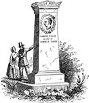
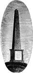
Paine's Monument
The monument in honor of Thomas Paine, the author, revolutionary, and intellectual of the American Revolution.
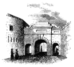
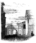
Palace Gate
Palace Gate, outside. This is one of the most beautiful gates of the city, and opens toward the St.…
Palace Gate
Palace Gate, inside. This sketch is a view from within Palace Street, looking out upon the open country…
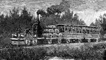
Passenger Train
"The first passenger locomotive built in the United States. A year after the Enterprise sailed for India,…
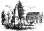
Paulding's Monument and St. Peter's Church
"Paulding's Monument and St. Peter's Church. The site of this church and the grave-yard was a gift of…
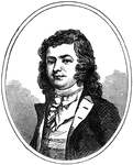
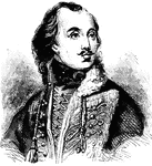
John Paulding
John Paulding (16 October 1758 – 18 February 1818) was a militiaman from the state of New York during…
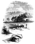
Peekskill Landing
"View from Peekskill Landing. This view is from Peekskill landing, looking up the river. On the left…
Penn's House
"Penn's House. This view is from Second Street. The building is of imported brick, except the modern…
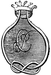
Penn's seal and signature
"Penn's Seal and Signature. This is a representation of the seal and signature of William Penn attached…
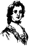
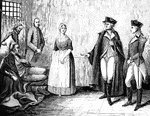
Mary Phillipse
(1370-1825) George Washington's first love who was one of the only women to be accused of Treason during…
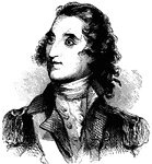
Thomas Pinckney
(1750-1828) American diplomat and soldier that served in the American Revolutionary war.
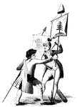
Pine-Tree Flag
"The Pine-Tree Flag. This engraving is a reduced copy of a vignette on a map of Boston, published in…

Pine-Tree Shilling
The Pine-Tree Shilling. This is a fac-simile of the first money coined in America. The mint-master,…
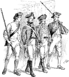
Major Pitcairn
Major John Pitcairn was one of the more reasonable officers of the British military. He was a Marine…
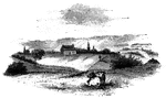
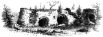
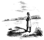
Plum Point
"Remains of fortifications at Plum Point. This view is from the interior of the redoubt looking eastward…
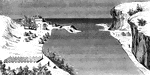
Point Levi
View of Point Levi from Durham Terrace, Quebec. This sketch is taken from Durham Terrace, near the north…
From the Right Bank of the Potomac
"One day there came marching into camp a regiment from Virginia, from the beautiful valley of the Shenandoah.…
Prescott's Headquarters
"Prescott's Headquarters. This house is on the east side of the west road, about a mile from the bay.…
Princeton battle-ground
"View of the battle-ground near Princeton. This view, looking north, is from the carriage gate of Mr.…
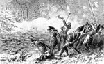
Battle of Princeton
A battle of the American Revolution, in which General Washington's troops defeated British forces near…
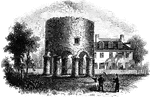
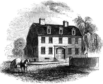
Providence Tavern
"Old Tavern in Providence. This view is from the market, looking north. The building stands on the east…
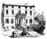
Province House
"The Province House. The Province House, the residence of the colonial governors, is still standing,…
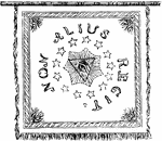
Pulaski's Banner Back
"Pulaski's Banner. On the other side, in the center, is the All-seeing Eye, with the words Non Alius…
Pulaski's Banner Front
"Pulaski's Banner. On one side of the banner are the letters U. S., and in a circle around them the…
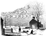
General Putnam's Land Office at Marietta
General Putnam's land office at Marietta during the American Revolution.
Fort Putnam
"Interior of Fort Putnam. This little sketch is a view of the remains of the casemates, or vaults, of…
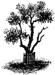
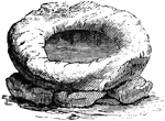
Pyle's Pond
"Pyle's Pond. About a quarter of a mile northwest from this pond, is the spot where the battle occurred.…
Queen Esther's Rock
Queen Esther's Rock. This view is near the ancient river bank, looking westward. The rock is a sort…
Raleigh Tavern
"Raleigh Tavern. When I visited Williamsburg in December, 1848, the front part of the old Raleigh tavern…
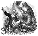
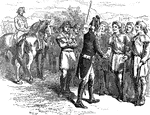
Colonel Rall
"Washington's visit to Colonel Rall. This is a copy, by permission, of a picture by Flagg, in the possession…