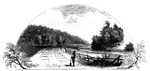
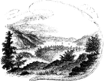
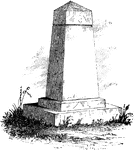
Fort Anne
Site of Fort Anne. This view is from the bridge which crosses Wood Creek, looking south. The distant…
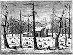
Battleground near Fort Anne
Battleground near Fort Anne. This sketch was taken from the rail-road, looking north. The forest upon…
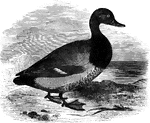
American Scaup Duck
The American scaup duck is common in North America, accidental in Europe. It is also known as the creek…
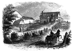
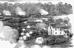
Fitch's Point
Fitch's Point, the landing-place of the British. This view is from the west side of Gregory's Point,…
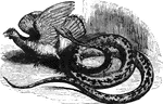
Python
"Pythons are the largest known serpents, which are found only in India and the islands of the Indian…
Fort Montgomery
"View near Fort Montgomery. This view is from an eminence near the mountain road, about three quarters…
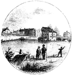
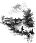
Peekskill Landing
"View from Peekskill Landing. This view is from Peekskill landing, looking up the river. On the left…
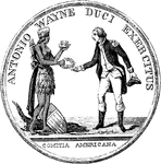
Wayne Medal Front
"Gold medal awarded by Congress to General Wayne. This is a representation of the medal, the size of…

Stewart Medal Front
"Medal awarded to Major Stewart. This represents the medal the size of the original. The device is America…
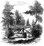
Sleepy Hollow
"Bridge over Sleepy Hollow Creek. Ichabod, according to Irving, in the Legend, returning from…
Trenton
"Trenton Bridge and vicinity. This view is from the north side of the Assanpink, a few rods above the…
Treaty Monument
"Treaty Monument. This monument stands near the intersection of Hanover and Beach Streets, Kensington,…
Jefferis' Ford
"View at Jefferis' Ford. This view is from the easterly bank of the Brandywine. The ford was at the…
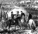
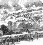
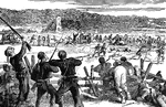
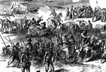
Battle of Pea Ridge
"Battle of Pea Ridge, Ark., fought March 6th, 7th and 8th, 1862, between the Federal forces, 13,000…
Battle of Pea Ridge
"Battle of Pea Ridge, Ark., fought March 6th, 7th and 8th, 1862, between the Federal forces, 13,000…
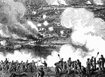
Battle of Malvern Hill
"Battle of Malvern Hill, near Turkey Bend, James River, Va., fought Tuesday, July 1st, 1862. The battle…
Battle of Malvern Hill
"Battle of Malvern Hill, near Turkey Bend, James River, Va., fought Tuesday, July 1st, 1862. The battle…
Battle of Malvern Hill
"Battle of Malvern Hill, near Turkey Bend, James River, Va., fought Tuesday, July 1st, 1862. The battle…
Battle of Malvern Hill
"Battle of Malvern Hill, near Turkey Bend, James River, Va., fought Tuesday, July 1st, 1862. The battle…
Battle of Malvern Hill
"Battle of Malvern Hill, near Turkey Bend, James River, Va., fought Tuesday, July 1st, 1862. The battle…
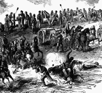
Lick Creek Bottom - Horse and Rider
"Advance of Federal troops on Corinth- the Carnival of Mud- scene at Lick Creek Bottom, between Pittsburg…
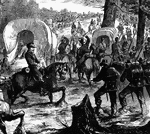
Lick Creek Bottom - In the Mud
"Advance of Federal troops on Corinth- the Carnival of Mud- scene at Lick Creek Bottom, between Pittsburg…
Lick Creek Bottom - Marching through the Mud
"Advance of Federal troops on Corinth- the Carnival of Mud- scene at Lick Creek Bottom, between Pittsburg…
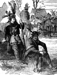
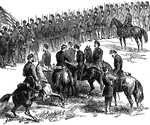
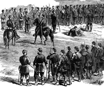
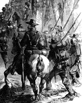
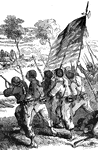
Delaware Indians
"Delaware Indians acting as scouts for the Federal army in the West. General Fremont, on taking command…
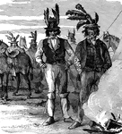
Delaware Indians
"Delaware Indians acting as scouts for the Federal army in the West. General Fremont, on taking command…
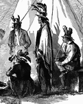
Delaware Indians
"Delaware Indians acting as scouts for the Federal army in the West. General Fremont, on taking command…
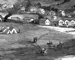
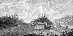
Village of Clarksburg
"Village of Clarksburg, Western Virginia, headquarters of General Rosecrans. Clarksburg, a post village,…
Village of Clarksburg
"Village of Clarksburg, Western Virginia, headquarters of General Rosecrans. Clarksburg, a post village,…
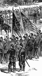
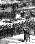
Battle of Antietam
"Battle of Antietam, Burnside's Division, left wing- brilliant and decisive bayonet charge of Hawkins's…
Battle of Antietam
"Battle of Antietam, Burnside's Division, left wing- brilliant and decisive bayonet charge of Hawkins's…
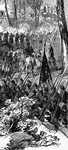
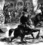
Battle of White Oak Swamp Bridge
"Battle of White Oak Swamp Bridge, Monday June 30th, 1862- Ayres's, Mott's and Randall's batteries checking…
Battle of White Oak Swamp Bridge
"Battle of White Oak Swamp Bridge, Monday June 30th, 1862- Ayres's, Mott's and Randall's batteries checking…
Battle of White Oak Swamp Bridge
"Battle of White Oak Swamp Bridge, Monday June 30th, 1862- Ayres's, Mott's and Randall's batteries checking…
Battle of White Oak Swamp Bridge
"Battle of White Oak Swamp Bridge, Monday June 30th, 1862- Ayres's, Mott's and Randall's batteries checking…
Sepiola
"Of this there are several species in the Atlantic, Indian, and Pacific Oceans. They are two to four…
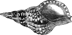
Marine trumpet-shell
"The marine trumpet or Triton's shell, Triton variegatus, is elegantly variegated with red…
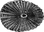
Greek fissurella
"The Greek Fissurella, F. Græca, is found in the Mediterranean and the Indian Ocean.…
Cowpens
"Scene at the Cowpens. This name is derived from the cirumstance that, some years prior to the Revolution,…
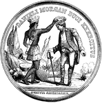
Morgan Medal Front
"Gold medal awarded to Morgan. The following are the devices and inscriptions upon the front of the…
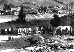
Sander's Creek
"View at Sander's Creek. This view is from the north side of the Creek. like the other stream, it is…
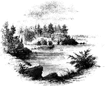
Turtle Bay
"View at Turtle Bay. Turtle Bay is a small rock-bound cove of the East River, at the foot of Forty-seventh…
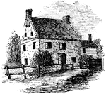
Cortelyou's House
"Cortelyou's House. This house, built of stone, with a brick gable from eaves to peak, is yet (1852)…
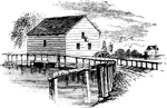
Brower's Mill
"Brower's Mill. This is a view of the old mill of the Revolution, as it appeared when I made the sketch…

Acacia
"An Egyptian tree; the bark and pods are frequently used in tanning and the aqueous extract of the wood…
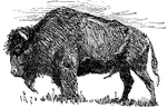
Buffalo
"The Buffalo. As the game upon which they depended moved about the country, so the Indians roved in…
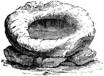
stockade
"A stockade. Those settlers who lived outside of Roston and the few seaport villages built palisades…
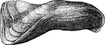
Lingula anatina
"The Lingula anatina has a long peduncle issuing from between the umbones. The valves are nearly…
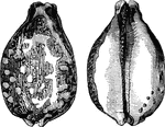
Cardium junonae
"The C. junonae is a very beautiful species. The great assemblage of the different kinds is…
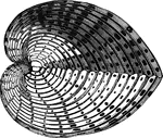
Arca tortuosa
"In the Arcacea the shells are nearly equal, usually thick and furnished with a long row of reeth at…
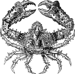
Parthenope horrida
"The Parthenope horrida, a native of the Atlantic and Indian Oceans, is covered with the most…
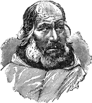
Eskimo Man
"Eskimo is the name of the inhabitants of the N. coast of the American continent down to lat. 60 degrees…