|
|
|
| Maps > United States > Early America 1400-1800 |
A collection of historic maps of early America from explorations and settlements of the English, French, and Spanish, to the end of the American Revolutionary War.
|
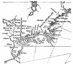
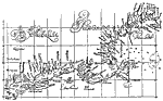
Part of De Laet's Map,
1630 |
|
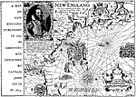
New England,
1631 |
|
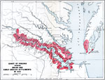
Chart of Early Virginia,
1632 |
|
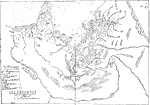
Winthrop Map,
1633 |
|
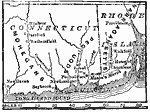
Pequod (Pequot) War,
1636–1638 |
|
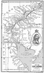
New Sweden,
1638–1655 |
|
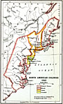
North American Colonies,
1643 |
|
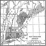
New England Grants,
1643–1684 |
|
From Dudley's Arcano del Mare,
1646 |
|
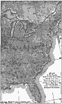
The Country East of The Mississippi,
1650 |
| First | Previous | Next | Last |
| Maps > United States > Early America 1400-1800 |
Maps ETC is a part of the Educational Technology Clearinghouse
Produced by the Florida Center for Instructional Technology © 2009
College of Education, University of South Florida