|
|
|
| Maps > United States > Growth of Nation |
A collection of historic maps of territorial acquisitions and growth of the United States for use in the K-12 classroom.

|
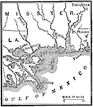
The Southwestern Operations,
1813–1815 |
|
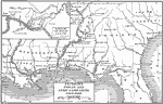
War in the Southwest,
1813–1815 |
|
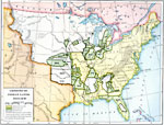
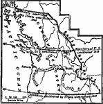
Jackson's Indian and Gulf Campaigns,
1813–1818 |
|
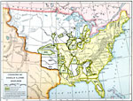
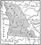
Cession of Native Lands,
1816–1830 |
|
Cessions of Native American Lands,
1816–1830 |
|
The Oregon Country,
1818–1846 |
|
Treaty with Spain,
1819 |
|
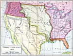
The Oregon Country,
1819–1846 |
|
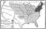
Freedom and Slavery,
1820 |
|
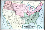
The Missouri Compromise,
1820 |
| First | Previous | Next | Last |
| Maps > United States > Growth of Nation |
Maps ETC is a part of the Educational Technology Clearinghouse
Produced by the Florida Center for Instructional Technology © 2009
College of Education, University of South Florida