| Maps > United States > Demographics |
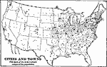 |
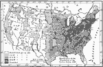
The United States - Cities and Towns, 1897 Map of United States showing the relative population. |
 |
Center of Population, 1700-1910 Center of population at each census 1790 to 1910. Median Point 1880 to 1910. |
 |
Population Density, 1790 A map showing population density in 1790 in the United States. |
 |
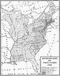
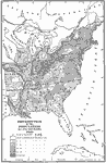
Distribution of Population, 1790 A map showing the distribution of population in 1790. |
 |
American Population, 1790 A map showing the population distribution in America in the year 1790. |
 |
Movement of the Center of Population, 1790 to 1910 This is a map showing "the center of population moving westward with varying degrees of rapidity, as indicated by the stars from 1790 to 1910." — Foster, 1921 |
 |
Distribution of Population, 1800 A map showing the distribution of population in 1800. |
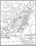 |
Distribution of Population, 1820 A map showing the distribution of population in 1820. |
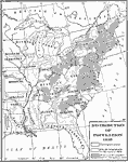 |
Distribution of Population, 1830 A map showing the distribution of population in 1830. |
 |
Population, 1840 A map showing the distribution of the population in 1840. |
 |
Distribution of Population, 1850 A map showing the population distribution of the United States in 1850. |
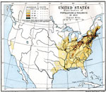 |
United States, 1850 Map of the United States, subtitled "Distribution of Population & Railways in 1850." Map is color-coded to show population density. |
 |
Center of population, 1850-1860 Map showing the center of population |
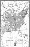 |
Population Distribution, 1860 A map showing the distribution of population in the eastern United States in 1860. |
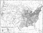 |
Population Distribution, 1870 A map showing the distribution of population in the United States in 1870. |
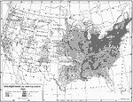 |
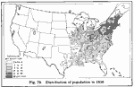
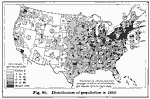
Distribution of Population, 1880 A map showing the distribution of population in the United States in 1890. |
 |
Distribution of Population, 1890 A map of the United States showing the distribution of population in 1890. |
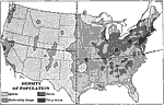 |
Density of Population, 1898 AD A map of the Density of Population in the contiguous 48 states as of 1898 AD. "The eastern half of the United States contains nearly nine tenths of the people in the country." &mdashRedway, 1898. |
 |
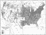
Population in United States, 1900 A map showing the distribution of population in the United States, 1900. |
 |
United States, 1900 Map of the United States, subtitled "Distribution of Population & Principal Railways in 1900." Map is color-coded to show population density. |
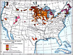 |
Distribution of Ethnicities, 1900 A map showing the distribution of ethnicities in the United States in 1900. |
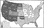 |
United States Growth in Population by Decades, 1900 to 1910 "This is a map classifying states with respect to the percentage of increase of population between twelfth and thirteenth censuses. The greatest growth has been in the central and western states, where the increase has been unusually large. This is due to the fertility of the soil in the Mississippi Valley and the opportunities and advantages offered by a new country." — Foster, 1921 |
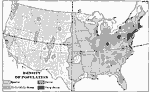 |
Density of Population in US, 1901 Map showing density of population in the United States. |
 |
Population Density, 1910 A map showing population density in the United States in 1910. |
 |
Movement of the Center of Population, 1920 A map showing the westward movement of the center of population in the United States up to 1920. |
| Maps > United States > Demographics |
Maps is a part of the Educational Technology Clearinghouse
Produced by the Florida Center for Instructional Technology © 2007
College of Education, University of South Florida