The 1763-1788 American Revolution Places ClipArt gallery provides 303 illustrations of the Apollo Room, Carpenter's Hall, Concord, Faneuil Hall, Mount Vernon, the Old South Meeting House, and other locations associated with the American War for Independence.
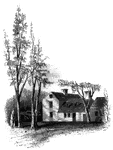
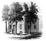
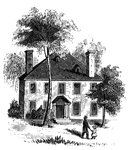
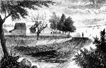
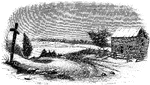
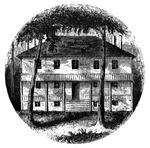
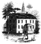
Clark's House
"Clark's House, Lexington. This building was standing when I visited Lexington in 1848. It was built…
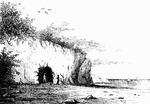
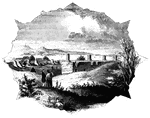
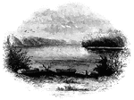
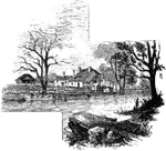
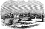
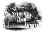
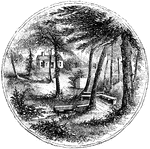
Compo
Distant view of Compo. This view is from the top of a high hill northeast of the dwelling of Mr. Ebenezer…
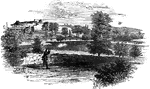
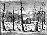
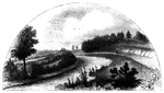
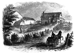
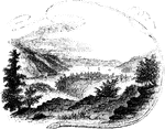
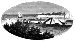
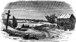
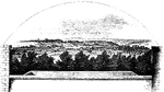
Battleground at Concord
"Battle ground at Concord. This view, looking southeast, is from the road leading to the village, by…
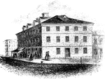
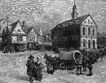
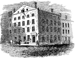
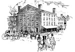
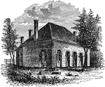
Congress House
"The Congress House. This view is from Baltimore Street, looking southeast. The ront on the left is…
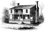
Constitution House
The Constitution House, Kingston. This house, the property and residence of James W. Baldwin, Esq.,…
!["View from the site of Fort Cornwallis. Fort Cornwallis occupied the ground in the rear of the Episcopal church, now a grave-yard. This view is from within the inclosure, looking northeast, and includes a portion of Schultz's bridge, the Savannah River, and Hamburg upon the opposite bank. In the foreground is seen portions of the church-yard wall, and upon the brink of the river below are [African Americans] employed in placing bales of cotton upon the wharves for transportation to the sea-coast. The wharves are two stories in height, one to be used at low water, the other when the river is 'up.' There were remains of the ditch and embankments of the fort within the grave-yard when I was there; and the trench leading to the water-gate, where the 'Pride-of-India tree is seen, was very visible."—Lossing, 1851](https://etc.usf.edu/clipart/14100/14143/ft-cornwalli_14143_mth.gif)
Fort Cornwallis
"View from the site of Fort Cornwallis. Fort Cornwallis occupied the ground in the rear of the Episcopal…
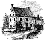
Cortelyou's House
"Cortelyou's House. This house, built of stone, with a brick gable from eaves to peak, is yet (1852)…
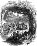
Cowpens
"Scene at the Cowpens. This name is derived from the cirumstance that, some years prior to the Revolution,…
Lydia Darrah's House
The house of Lydia Darrah (1728-1789). Lydia was a midwife and Philadelphia's first female undertaker.…
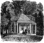
Garden House in Which Jefferson Celebrated the Passage of the Declaration
The garden house in which Jefferson and others celebrated the passage of the Declaration of Independence.
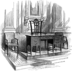
Table and Chair Used at the Signing of the Declaration of Independence
The table and chair used at the signing of the Declaration of Independence.
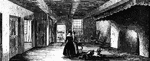
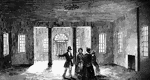
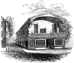
Dining-Hall
"The dining-hall, or room with seven doors. In the December number of the New York Mirror for 1834,…
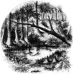
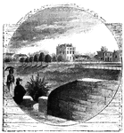
Eutaw Spring
"Eutaw Spring, where there was a conflict during the American Revolution."—Lossing, 1851

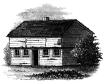
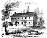
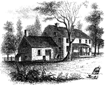
Mrs. Falls'
"Mrs. Falls'. This house, now (1850) owned by Mr. Samuel Moore, is a frame building, and stands on the…
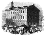
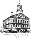
Faneuil Hall
"Faneuil Hall has been denominated 'the cradle of American liberty,' having been the popular gathering-place…
first interview
Site of the first interview between Gates and Burgoyne. This view is taken from the turnpike, looking…
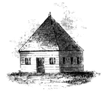
First Meeting House
First meeting hall. This picture of the first house for Christian worship erected in Connecticut is…
Fitch's Point
Fitch's Point, the landing-place of the British. This view is from the west side of Gregory's Point,…
Fort Anne
Site of Fort Anne. This view is from the bridge which crosses Wood Creek, looking south. The distant…
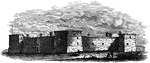
Fort at Chambly
Fort at Chambly, this is a view of the south and west sides of the fort, looking toward the river. It…
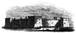
Fort Chambly
Fort Chambly at the foot of the Chambly rapids on the Richelieu River in Quebec, Canada, was built by…
Fort Miller
Fort Miller fording-place. This was the crossing-place for the armies; and there are still to be seen…
Fort Montgomery
"View near Fort Montgomery. This view is from an eminence near the mountain road, about three quarters…
Fort Niagra
Distant view of Fort Niagra. This view is from the west side of the Niagra River, near the light-house.…
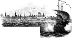
Fort Oswego
View of Oswego and the Fort in 1798. This view is from the west side of the river, near the site of…
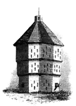
Fort Plain
Fort Plain block-house. There is considerable confusion in the accounts concerning Fort Plain, for which…
Fraunces Tavern
In August of 1775, Americans took possession of cannons from the Battery at the tip of Manhattan and…
Fraunces' Tavern
The Fraunces' Tavern in 1783. It was originally the home for Oliver de Lancey who sold it to Samuel…
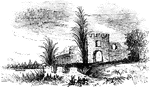
Frederica
"Ruins of Oglethorpe's Barracks at Frederica. This is from a sketch made by W. W. Hazzard, Esq., in…
!["View of the remains of the French Works. These remains are in the southeastern suburbs of the city, about half way between the [African American] Cemetary and the residence of Major William Bowen, seen toward the right of the picture. The banks have an average height, from the bottom of the ditch, of about five feet, and are dotted with pines and chincapins or dwarf chestnuts, the former draped with moss. The ground is an open common, and although it was mid-winter when I was there, it was covered with green grass, bespangled with myriads of little flowers of stellar form. This view is from the direction of the town looking southeast."—Lossing, 1851](https://etc.usf.edu/clipart/14100/14147/french-works_14147_mth.gif)
French Works
"View of the remains of the French Works. These remains are in the southeastern suburbs of the city,…
Friends' meeting-house
"Friends' meeting-house. This view is from the shed in the yard, looking southeast. The building stands…
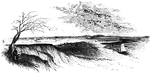
Gaspee Point
"Gaspee Point. This view is from the bank of the cove just below the Point, looking northeast, showing…
Gravesend Bay
"View at Gravesend Bay. This view is from the road on the high shore, a little below Fort Hamilton,…
Greene and Knox Head-Quarters
"Head-quarters of Greene and Knox. This view is from the turnpike road, looking southeast. The water…
General Nathanael Greene Crossing the River Dan
Nathanael Greene was a major general of the Continental Army in the American Revolutionary War. Here…
Guilford Battle-ground
"View of the battle-ground. This view is from the eminence southwest of the site of old Guilford Court…
Guilford Courthouse
The site of the Guilford Courthouse battle, a pivotal battle of the American Revolution. This battle…
The Battlefield of Guilford
The Battle of Guilford Court House was a battle fought on March 15, 1781 inside the present-day city…
Guy Park
This was the residence of Colonel Guy Johnson, and is still standing, on the north side of the Mohawk,…
Hancock's House
"Hancock's House, Boston. This is a substantial stone building, situated upon Beacon Street, fronting…
Hanover Courthouse
Hanover County Courthouse is the place where Patrick Henry practiced law and argued the case accusing…
Hobkirk's Hill
"View at the Spring; Hobkirk's Hill. It is at the hed of a ravine, scooped out of the northeastern slope…
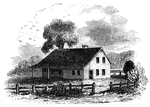
Hopper House
"The Hopper House. This view is from the road, looking northeast. The low part, on the left, is a portion…