Maps Site map
  Maps > Globes & Multi-Continent > Regional Maps >Regional Atlantic Ocean
Site Map  

  Record   1   to   10  of   28

Regional Globes & Multi-Continental maps of the Regional Atlantic Ocean region from the Maps ETC collection. This may include physical and political maps, early history and empires, climate maps, relief maps, vegetation maps, population density and distribution maps, cultural maps, and economic/resource maps.

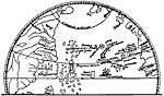
Atlantic Ocean, Toscanelli, 1474
This map is a representation of the map and letter sent to the court of Lisbon by Palolo dal Ozzo Toscanelli in 1474. This was thought to be the westward route to the Spice Islands and was carried with Christopher Columbus during his first voyage to ...

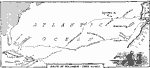
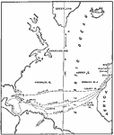
Route of the First Voyage of Columbus, 1492
A map of the North Atlantic showing the outward and homeward routes of the first voyage of Christopher Columbus to the New World. The map shows the home port of Palos, Spain (Palos de la Frontera), and the route to the Canary Islands, the landing at ...

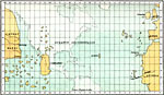
The Ocean and Islands Between Western Europe and Eastern Asia, 1492
From the globe of Martin Behaim. Map of the ocean that was thought to lie between the west coast of Europe and the East Coast of Asia. This map was created shortly before Christopher Columbus discovered the continent of North America. China is labele...

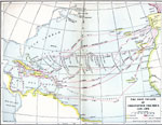
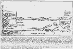
The Four Voyages of Columbus, 1492–1503
A map of the North Atlantic showing the routes, directions, and dates of the four voyages of Columbus, from 1492 to 1503. This map is color-coded to show the territories in Africa, South America, and Atlantic islands claimed by the Portuguese, and te...

The Lines of Demarcation, and the Routes of Columbus's Voyages, 1492–1504
Map showing The Lines of Demarcation, and the Routes of Columbus's Voyages....

The New World according to Columbus, 1506
A facsimile of a map prepared by Bartholomew Columbus soon after the death of his brother the admiral (1506), to enlist the interest of the pope in his projects to colonize and Christianize Veragua. ...

The Bordone Map, 1547
A facsimile of the Benedetto Bordone Map (1547), possibly showing the Azores Islands in the Atlantic, with S. Georgio (Sao Jorge), Samguimi (Sao Miguel), and S. Maria (Santa Maria)....

Bordone's Isolario, 1547
A facsimile of a section of the Benedetto Bordone's Isolario, showing part of Spain, Portugal, and Africa. ...

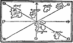
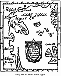
Sigurd Stephanius Map, 1570
A facsimile of a 1570 North Atlantic map from the Icelandic geographer Sigurd Stephanius, showing part of western Norway (Norvegia), Britain (Britannia), Ireland (Ir Land), Orkney Islands (Orcades), Shetland Islands (Hetland), Faroe (Fero), Iceland, ...

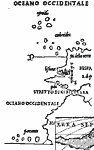
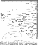
Gaffarel's Map of the Atlantic, 1571
A facsimile from a map of the North Atlantic by Jacques Gaffarel (1601–1681), showing "such rocks and islets as have from time to time been reported as seen, or thought to have been seen, and which Gaffarel views as vestiges of the lost co...

Next Last


  Maps > Globes & Multi-Continent > Regional Maps >Regional Atlantic Ocean
Site Map  

Maps is a part of the Educational Technology Clearinghouse
Produced by the Florida Center for Instructional Technology © 2009
College of Education , University of South Florida