| Maps > United States > Eastern Region |
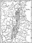 |
Drainage Map of the Appalachian Region, 1911 A drainage map of the Appalachian region. |
 |
Development of Three Peneplains in the Chattanooga District, 1911 A map showing the relative development and preservation of three peneplains in the southern half of the Chattanooga district. Darkest areas, base-leveled areas of the late Tertiary or Coosa peneplain; lightest shade, early Tertiary or Highland Rim peneplain; intermediate shade, remnants of the Cretaceous or Cumberland peneplain. Residuals above the Cumberland peneplain are shown in slightly darker shade. |
 |
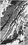
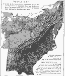
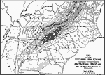
Southern Appalachians, 1911 A relief map of the Southern Appalachian region. |
 |
Mountains in Virginia, 1911 A map of the Blue Ridge, Catoctin Mountain and Bull Run Mountain in Virginia. Blank areas represent Tertiary peneplain; shaded areas represent remnants of Cretaceous peneplain now appearing as residuals above the Tertiary level. |
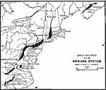 |
Areas Occupied by the Newark System, 1911 A map showing the local development of Triassic rock in the older Appalachians. The arrows indicate the direction in which the strata dip. |
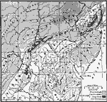 |
Older Appalachians, 1911 A map showing the four crystalline prongs of the older Appalachians which enclose the New York-Virginia area of Newark rocks. |
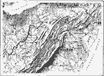 |
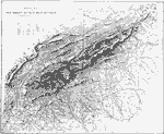
Central Appalachians, 1911 A relief map of the central part of the Appalachian System. |
 |
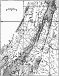
Cumberland Plateau, 1911 A map of the Cumberland Plateau. On the right is the summit of the plateau; on the left is the surface of the Highland River; between is a belt of rugged country which marks the descent from the higher to the lower level. |
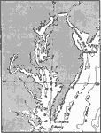 |
Chesapeake Bay, 1911 A map showing Chesapeake Bay and Delaware Bay and the principal bays tributary to them. |
 |
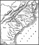
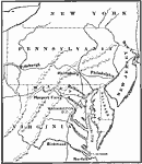
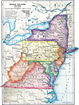
Middle Atlantic States, 1778-1779 A map of the Middle Atlantic States. |
 |
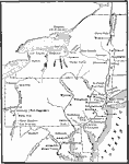
Operations in the South, 1780-1781 A map of operations in the South, 1780-1781. |
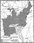 |
Presidential Election, 1836 A map showing the presidential election of 1836. |
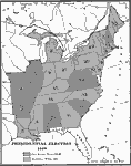 |
Presidential Election, 1840 A map showing the presidential election of 1840. |
 |
Approach to Washington, 1860 The Routes of Approach to Washington. |
 |
Relief Map of State East of the Mississippi River, 1872 Relief map of states east of the Mississippi River. |
 |
Atlantic Coast Tides, 1885 Tide heights at various points along the Atlantic seaboard. |
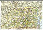 |
Railroad and County Map of Virginia and West Virginia, 1892 Railroad and county map of Virginia and West Virginia. |
 |
Statehood, 1899 Shows dates that states of Indiana, Maryland, Ohio, Pennsylvania, Washington D.C., and West Virginia were admitted to the Union. |
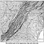 |
Northern Appalachian Ridge and Valley, 1901 "The northern part of the Appalachian ridge and valley belt."—Natural Advanced Geography, 1901 |
 |
The Northeast United States, 1903 A map of the Northeastern United States in 1903. |
 |
Detroit, Cleveland, Cincinnati, and Pittsburg, 1910 A map showing the location of Detroit, Cleveland, Cincinnati, and Pittsburg, and their relation to the trade routes of the Central and Middle Atlantic States. |
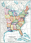 |
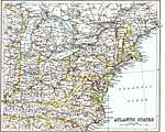
The Eastern United States, 1910 A map of the eastern United States. |
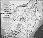 |
Relief Map of the Middle Atlantic States, 1910 A relief map of the Middle Atlantic states. |
 |
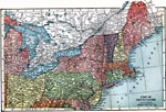
The Middle Atlantic States, 1910 A map of the Middle Atlantic states. |
 |
The Fall Line, 1910 A map showing the Fall Line. There are rapids and falls along this line, because the streams have been able to dig more rapidly into the soft layers of the Coastal Plains than into the harder rocks of the Piedmont Plateau. |
 |
Map of the Southern Appalachians, 1911 A map showing the areas of deformation represented by broken lines, AB, CD, EF, GH, and OP. Contours represent elevations of restored surface. |
 |
Atlantic States, 1911 This map is an early 20th century illustration of the States considered the Atlantic States. |
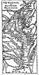 |
Waterways to Baltimore and Washington, 1919 A map showing the waterways to Baltimore and Washington. |
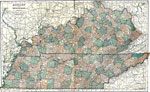 |
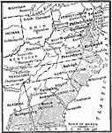
Kentucky and Tennessee, 1920 The states of Kentucky and Tennessee. |
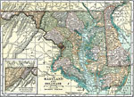 |
Maryland and Delaware, 1920 The states of Maryland and Delaware. |
| Maps > United States > Eastern Region |
Maps is a part of the Educational Technology Clearinghouse
Produced by the Florida Center for Instructional Technology © 2007
College of Education, University of South Florida