 |
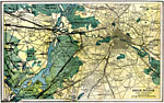
Berlin, Potsdam, and Vinicinity, 1903 A map of Berlin, Potsdam, and the vinicity in 1903. |
 |
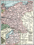
Germany - Western Section, 1909 Map of western Germany. |
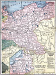 |
Germany - Eastern Section, 1909 Map of eastern Germany. |
|
Berlin, Potsdam, and Vinicinity, 1903 A map of Berlin, Potsdam, and the vinicity in 1903. |
 |
Berlin, Map to show Berlin and surrounding country. |
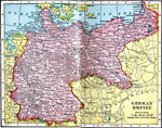 |
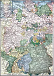
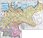
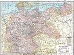
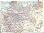
German Empire, 1906 Map of German Empire in 1906. |
 |
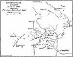
The Saar Basin, 1919 A map showing the Sarr Basin, formerly an important coal-mining area. |
 |
Napoleonic Campaigns, 1800-1815 A map of Germany, where parts of the Napoleonic Wars were fought. |
 |
The Jena Campaign, 1806 A map of the Jena Campaign, during the Napoleonic Wars. |
 |
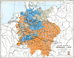
Formation of the German Empire, 1806-1871 Formation of the German Empire between 1806 and 1871. |
|
German Empire, 1906 Map of German Empire in 1906. |
 |
Battle of Jena, 1806 A map where the Battle of Jena was fought during the Napoleonic Wars. |
 |
Auerstadt, 1806 A map of Auerstadt, where a battle of the Napoleonic Wars was fought. |
 |
Eckmuhl, 1809 A map of Eckmuhl from the Napoleonic Wars. |
 |
Campaign in 1813, 1813 A map showing the campaign of 1813 during the Napoleonic Wars. |
 |
Germany, 1872 Physical map of Germany. |
 |
Germany - Schmalkaldic War, 1547-1554 Map showing Germany during the time of the Schmalkaldic War. Map is color-coded to show Saxony under different rules during this period. |
 |
Religious Divisions of Germany c. 1610, 1610 Map showing religious divisions of Germany, circa 1610. Map is color-coded to show boundaries. |
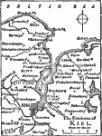 |
Kiel, 1919 A map showing the environs of Kiel. |
 |
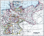
Germany, 1920 Germany, showing railroads, submarine cables, and canals. |
 |
Germany, 1910 Map shows Germany. |
 |
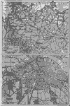
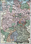
Central Germany, 1910 Map shows Central Germany. |
|
The Saar Basin, 1919 A map showing the Sarr Basin, formerly an important coal-mining area. |
 |
Germany, 1920 Map of Germany. |
 |
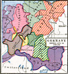
Germany, 1919 A map showing Germany and its subdivisions in 1919. |
 |
Eastern Germany, 1919 A map of the eastern section of Germany in 1919. |
 |
Central Germany, 1920 The central region of Germany. |
|
Kiel, 1919 A map showing the environs of Kiel. |
|
Germany, 1910 Map shows Germany. |
|
Central Germany, 1910 Map shows Central Germany. |
|
Germany, 1919 A map showing Germany and its subdivisions in 1919. |
|
Eastern Germany, 1919 A map of the eastern section of Germany in 1919. |
 |
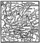
Koniggratz, March 7, 1866 Koniggratz, on the morning of July 3, 1866. |
|
Germany - Western Section, 1909 Map of western Germany. |
|
Germany - Eastern Section, 1909 Map of eastern Germany. |
 |
Germany, 1920 Physical map of Germany. Includes railroads, canals, and submarine cables. |
|
Koniggratz, March 7, 1866 Koniggratz, on the morning of July 3, 1866. |
 |
Germany divided into 10 circles, 1543 Map of Germany divided into 10 circles. Map is color-coded to differentiate between the various archbishops in power throughout the area. |
| Maps > Europe > Germany |
Maps is a part of the Educational Technology Clearinghouse
Produced by the Florida Center for Instructional Technology © 2007
College of Education, University of South Florida