Maps Site map
  Maps > Globes and Multi-continent > Complete Maps
Site Map  

  Record   71   to   80  of   316

A collection of world and multi-continent maps, including various projections, hemispheric maps, physical and political maps, early known world maps, climate maps, relief maps, ocean current maps, population density and distribution maps, vegetation maps, and economic/resource maps.
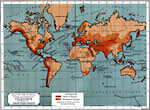
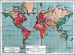
Map of the World Showing the Distribution of Volcanoes and Region of Earthquakes, 1891
A world map from 1891 showing the distribution of volcanoes and regions of earthquakes. This map is color–coded to show volcanic regions and earthquake regions, with the frequency of shocks in the earthquake regions indicated by the depth of sh...

Land and Water Hemispheres, 1891
A double hemisphere map of the world from 1891 showing the earth's Land Hemisphere and Water Hemisphere. "The accumulation of the land in the north and its separation in the south lead to a curious result — nearly all the land is collected...

Hydrographical Map showing the Oceanic Areas and River Systems of the Earth, 1891
A Hydrographical map from 1891 showing the oceans and river drainage systems of the globe. The map is color–coded to show the drainage systems of the Atlantic, Pacific, Arctic, and Indian oceans, and inland basins that do not drain to the ocean...

Co-Tidal Chart, 1891
A map from 1891, showing the progress of the daily lunar tidal wave in each of the oceans. "Although a tidal wave is formed in all parts of the ocean where the moon is overhead, yet the ‘Cradle of the Tides’ may properly be located i...

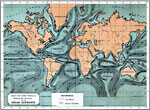
Map of the World showing the direction of the Ocean Currents, 1891
Map showing the direction of the Earth's ocean currents. ...

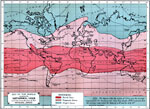
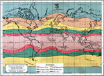
Map of the World showing the Isothermal Lines and the boundaries of the Physical Zones, 1891
A world map from 1891 showing the isothermal lines and the boundaries of the physical temperature zones. This map is color–coded to show the Torrid Zone, Temperate Zones, and Frigid Zones as defined by mean isotherms, with the torrid zone betwe...

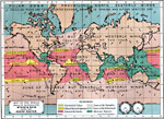
Map of the World showing the distribution of the Wind & Rain together with Ocean Routes, 1891
A world map from 1891 showing the distribution of the winds and rain, together with ocean routes. This map is color-coded to show Equatorial Calms and Doldrums, Calms of Cancer and Capricorn, Zones of the Trades, Zones of the Variables, Zones of the ...

Declination Chart, 1891
A world chart from 1891showing the Earth's east-west declination of the magnetic poles from the geographic poles. "Lines connecting places which have the same declination, are called isogonal lines. Lines connecting these places, when the needle...

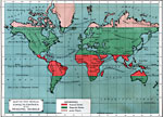
Map of the World showing the distribution of Vegetation according to the Zones of Physical Climate, 1891
A world map from 1891 showing the distribution of vegetation according to the zones of physical climate. This map is color-coded to show the Tropical Zone, Sub-Tropical Zones, Warm Temperate Zones, Cold Temperate Zones, Sub-Arctic Zone, and Polar Zon...

Map of the World showing the distribution of its Principal Animals, 1891
A world map from 1891 showing the regions and distribution of fauna. The map is color–coded to show regions of tropical, temperate, and arctic fauna, based on lines of latitude. The districts of several "principal"e animals are outline...

First Previous Next Last


  Maps > Globes and Multi-continent > Complete Maps
Site Map  

Maps ETC is a part of the Educational Technology Clearinghouse
Produced by the Florida Center for Instructional Technology © 2009
College of Education, University of South Florida