| Maps > Asia > A Complete Map of Asia |
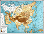 |
Asia (Physical), Map showing land elevation throughout Asia. |
 |
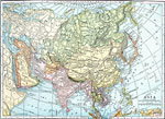
Asia, Map showing Asia. |
 |
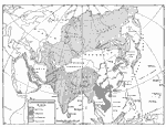
Asia (Physical), Map showing physical features of Asia. |
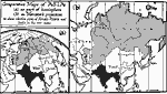 |
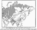
Comparitive Maps of Asia, 1800-1899 Comparative maps of Asia, as part of a hemisphere and on a Mercator's projection. |
 |
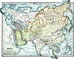
Asia, 1885 Asia, showing major mountain ranges. |
 |
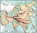
Orographic Chart of Asia, 1891 Chart showing the various mountain ranges in Asia. |
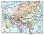 |
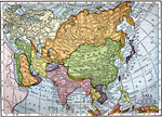
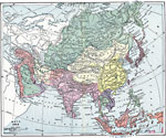
Asia, 1899 Map of Asia in color. |
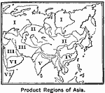 |
Product Regions of Asia, 1899 Map illustrates the chief products produced in Asia. |
 |
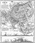
Asia, 1903 A map of Asia. |
 |
Asia, 1906 Map of Asia in 1906. |
 |
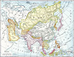
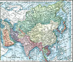
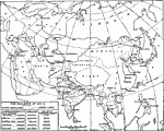
Asia, 1909, 1909 A map of Asia in 1909, showing old political boundaries and colonial possessions. |
 |
Asia, 1909 Map of Asia. |
 |
Asia in 1914, 1914 A map showing Asia in 1914. |
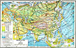 |
Physical Map of Asia, 1916 A map of Asia showing elevation of land, depth of water and isothermal lines. |
 |
The Railways of Asia, 1919 A map showing the railways networks in Asia as they were in 1919. |
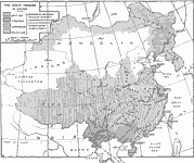 |
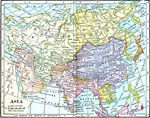
The Great Powers in China, 1919 A map showing the division of China into the various "spheres of influence". |
 |
Asia, 1920 A map of the Continent of Asia. |
 |
European Eminent Domain in Asia, 1921 A map showing imperialist possessions in Asia in 1921. |
| Maps > Asia > A Complete Map of Asia |
Maps is a part of the Educational Technology Clearinghouse
Produced by the Florida Center for Instructional Technology © 2007
College of Education, University of South Florida