| Maps > Europe > Greece |
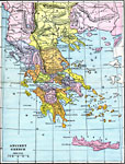 |
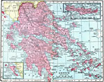
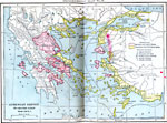
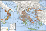
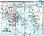
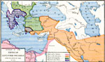
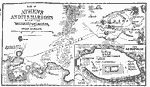
Ancient Greece, 1912 |
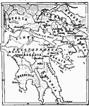 |
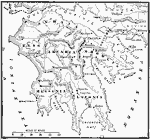
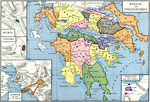
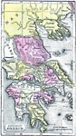
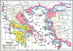
Southern Greece, 1876 |
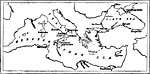 |
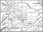
The Greek Colonies, 1876 |
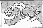 |
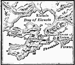
Salamis and the Coast of Africa, 1876 |
|
Southern Greece, 1876 |
|
The Greek Colonies, 1876 |
|
Salamis and the Coast of Africa, 1876 |
 |
Greece, 1906 Map of Greece in 1906. |
|
Greece, 1906 Map of Greece in 1906. |
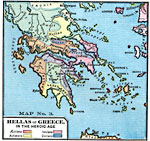 |
Hellas or Greece in the Heroic Age, Heroic Age, approx 500 B.C. Hellas or Greece in the Heroic Age. — Comprehensive Geography, 1872 |
 |
Hellas: The Aegean Lands, 1250 B.C. Map showing The Aegean Lands. |
 |
Central Greece and the Peloponnesus, 1250 B.C. Map showing Central Greece and the Peloponnesus. |
 |
The Peloponnesus, 1250 B.C. Map showing the Peloponnesus. |
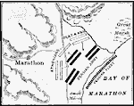 |
Battle of Marathon, 490 B.C. Map showing the Battle of Marathon, 450 B.C. |
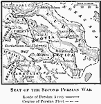 |
Seat of the Second Persian War, 481 B.C. Map showing the Seat of the Second Persian War, 481 B.C. |
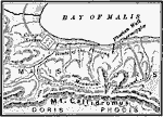 |
Pass of Thermopylae, 480 B.C. Map showing the Pass of Thermopylae, 480 B.C. |
 |
Battle of Salamis, 480 B.C. Map showing the Battle of Salamis, 480 B.C. |
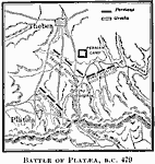 |
Battle of Plataea, 479 B.C. Map showing the Battle of Plataea, 479 B.C. |
 |
The Walls of Athens, 457 B.C. Map showing the Walls of Athens, 457 B.C. |
 |
Athenian Empire - Its Greatest Extent, 450 B.C. Map showing the Athenian Empire, 450 B.C. |
 |
Plan of Athens, Time of Pericles, 479-431 B.C. Map showing Athens in the time of Pericles, 479-431 B.C. |
 |
Sketch of the Agora, 479-431 B.C. Sketch of the Agora, 479-431 B.C. |
 |
Plan of the Acropolis, 479-431 B.C. Map showing Plan of the Acropolis, 479-431 B.C. |
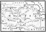 |
Boeotia, 379 B.C. Map of Boeotia. |
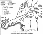 |
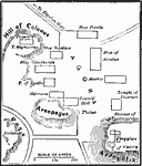
Plan of Ancient Athens, Ancient Athens A map showing the plan of ancient Athens, according to that given in Barthelemy's Anacharsis. |
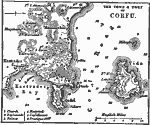 |
Corfu, 1919 A map of the town and port of Corfu, an island of Greece. |
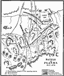 |
Platæa, 479 A map showing the battle of Platæa, 479 B.C. |
 |
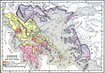
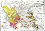
Hellas, about 550 B. C. Map of Hellas. Map is color-coded to show inhabitants of various regions of Greece. |
 |
, Fifth Century B.C. A map showing Greece in the fifth century B.C. |
 |
Hellas and Peloponnesus, about 300 B. C. Map of Hellas and Peloponnesus. Map is color-coded to political divisions of various regions of Greece. |
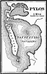 |
Pylos, Peloponnesian War A map of Pylos. |
 |
Eastern Part of Hellas and Peloponnesus, about 444 B. C. Map of Hellas and Peloponnesus. Map is color-coded to political divisions of various regions of Greece. |
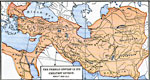 |
The Persian Empire in its Greatest Extent, about 500 B. C. Map of the Persian Empire in its Greatest Extent. |
 |
The March of Cyris Minor, and the Retreat of the 10,000 under Xenophon, about 401 B. C. Map of the March of Cyris Minor, and the Retreat of the 10,000 under Xenophon. |
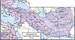 |
The Empire of Alexander the Great, about 323 B. C. Map of the Empire of Alexander the Great in 323 B. C. Tiny inset map of Granicus in 334 B. C. |
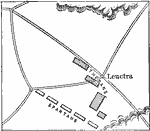 |
Battle of Leuctra, Ancient Greece A map showing the plan of the Battle of Leuctra, 371 B.C. |
 |
Division of the The Empire of Alexander the Great after the Battle of Ipsus, 301 B. C., about 301 B. C. Map of the Division of the The Empire of Alexander the Great after the Battle of Ipsus in 301 B. C. Map is color-coded to show political divisions in various regions of Greece. |
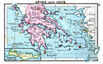 |
Greece with Crete, 1920 Greece with detail of Crete. |
|
Plan of Ancient Athens, ancient athens A map showing the plan of ancient Athens, according to that given in Barthelemy's Anacharsis. |
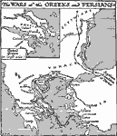 |
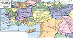
The Wars of the Greeks and Persians, Ancient Greece A map showing the wars of the Greeks and the Persians during the time of Xerxes. |
 |
Ancient Greece, Early Ages of the World, prior to Commencement of Grecian History Map of Ancient Greece. |
 |
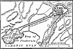
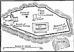
Plan of Athens and its Harbors with the Surrounding Country, Early Ages of the World, prior to Commencement of Grecian History Map of Athens and its Harbors with the Surrounding Country. |
 |
Greece and War with Persia, 560-490 B.C. A map showing Greece at the time of the war with Persia. |
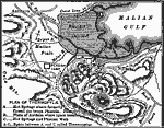 |
Plan of Thermoplyae, 480 B.C. A map showing the plan of Thermopylae during the war between Greece and the Persians. |
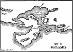 |
Map of Salamis, ancient greece A map showing the region around Salamis in ancient times. |
 |
Greece in the Peloponnesian War, 431-404 B.C. A map showing Athens, Sparta, and their allies during the Pelonponnesian War. |
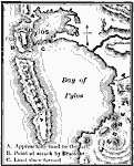 |
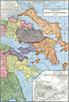
Bay of Pylos, 425 B.C. Map showing the Bay of Pylon, with notatoins relevant to the Peloponnesian War. |
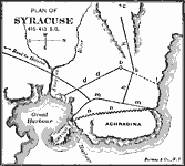 |
Plan of Syracuse, 415-413 B.C. A map showing the plan of Syracuse during the years 415 B.C. to 413 B.C., during the Peloponnesian War. |
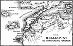 |
Map of the Hellespont, 405 B.C. A map showing the Hellespont, and the surrounding territory during the Peloponnesian War. |
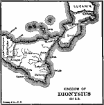 |
kingdom of Dionysius, 367 B.C. A map showing the Kingdom of Dionysius I, in 367 B.C. |
 |
Greece after the Battle of Mantineia, 362 B.C. A map of Greece after the Battle of Mantineia, in 362 B.C. |
|
Corfu, 1919 A map of the town and port of Corfu, an island of Greece. |
 |
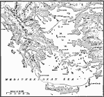
Reference Map of Greece, Ancient Greece A reference map of Greece. |
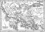 |
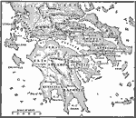
Physical Greece, Ancient Greece A map of physical Greece. |
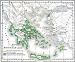 |
The Mycenean Age, Mycenean A map showing Greece during the Mycenean age. |
 |
Greece at the Dawn of History, 700 B.C. Greece at the Dawn of History. |
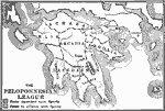 |
The Peloponnesian League, 500 B.C. A map showing the Peloponnesian League. |
|
Greece and War with Persia, 560-490 B.C. A map showing Greece at the time of the war with Persia. |
|
Plan of Thermoplyae, 480 B.C. A map showing the plan of Thermopylae during the war between Greece and the Persians. |
|
Map of Salamis, Ancient Greece A map showing the region around Salamis in ancient times. |
|
Greece in the Peloponnesian War, 431-404 B.C. A map showing Athens, Sparta, and their allies during the Pelonponnesian War. |
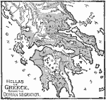 |
Greece Before the Dorian Migration, Dorian Migration A map of Greece before the Dorian migration. |
|
Bay of Pylos, 425 B.C. Map showing the Bay of Pylon, with notatoins relevant to the Peloponnesian War. |
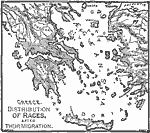 |
Greece After Migration, Ancient Greece A map of ancient Greece showing the distribution of races after their migration. |
|
Plan of Syracuse, 415-413 B.C. A map showing the plan of Syracuse during the years 415 B.C. to 413 B.C., during the Peloponnesian War. |
|
Map of the Hellespont, 405 B.C. A map showing the Hellespont, and the surrounding territory during the Peloponnesian War. |
|
kingdom of Dionysius, 367 B.C. A map showing the Kingdom of Dionysius I, in 367 B.C. |
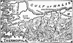 |
Thermopylae, Ancient Greece A map of Thermopylae. |
|
Greece after the Battle of Mantineia, 362 B.C. A map of Greece after the Battle of Mantineia, in 362 B.C. |
|
Platæa, 479 A map showing the battle of Platæa, 479 B.C. |
|
The Wars of the Greeks and Persians, ancient greece A map showing the wars of the Greeks and the Persians during the time of Xerxes. |
|
, fifth century b.c. A map showing Greece in the fifth century B.C. |
|
Pylos, peloponnesian war A map of Pylos. |
|
Battle of Leuctra, ancient greece A map showing the plan of the Battle of Leuctra, 371 B.C. |
|
Ancient Greece, 1912 |
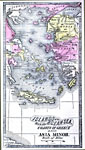 |
Islands of the Aegean Sea with the coasts of Greece and Asia Minor, Early Ages of the World, prior to Commencement of Grecian History Map of Islands of the Aegean Sea with the coasts of Greece and Asia Minor. |
| Maps > Europe > Greece |
Maps is a part of the Educational Technology Clearinghouse
Produced by the Florida Center for Instructional Technology © 2007
College of Education, University of South Florida