| Maps > North America > Regional Maps |
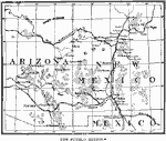 |
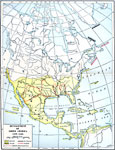
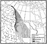
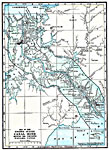
The Pueblo Region, A map of the Pueblo region of the American Southwest and Mexico. |
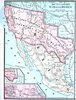 |
War with Mexico, Maps to illustrate America's War with Mexico. |
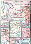 |
The War of 1812-1814, Maps to illustrate America's War with Mexico. |
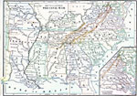 |
The Civil War, Maps to illustrate America's War with Mexico. |
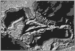 |
West Indies, A relief map of North America showing the West Indian chain of mountains rising from the bed of ashes. |
 |
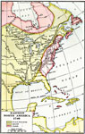
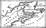
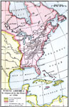
North America in 1689, A map of North America showing European claims, occupations, and settlements in 1689. |
 |
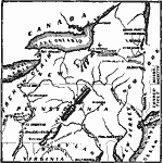
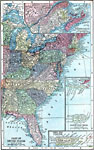
A map of the Northeast, Colonial America A map showing Canada and New York during the colonial era. |
 |
Lake Agassiz, A map of the extinct Lake Agassiz and other glacial lakes. |
 |
Development of North America, 1492-1564 A map showing the development of North America from 1492 to 1564. |
 |
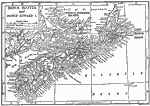
Early Discoveries and Explorations, 1497-1609 Map of Early Discoveries and Explorations. |
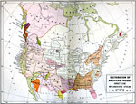 |
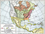
Distribution of Native Americans, 1500 A map showing the distribution of Native Americans around 1500 by linguistic stocks. |
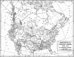 |
Distribution of American Indians, 1500 Map showing the distribution of American Indians in about 1500 by linguistic stocks. |
 |
Early Voyages of the Spaniards from Cuba and other islands, 1512-1580 Map of Early Voyages of the Spaniards from Cuba and other islands. |
 |
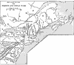
French Discoveries, 1600-1762 A map showing the progress of French discovery in the interior from 1600 to 1762. |
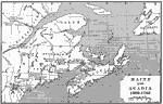 |
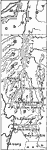
Maine and Acadia, 1603-1763 A map of Maine and Acadia from 1603 to 1763. |
 |
Champlain and Mohawk Frontiers, 1609-1763 A map showing the Champlain and Mohawk frontiers. |
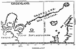 |
Greenland, 1647 An early map of the Greenland coast. |
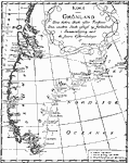 |
Greenland, 1668 An early map of Greenland. |
 |
Eastern North America, 1740 A map of Eastern North America in 1740. |
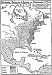 |
North America in 1750, 1750 A map showing territories held by the British, French, and Spanish in North America in 1750. |
 |
Chief Scene of Operations - French and Indian War, 1754-1755 Map of the chief scene of operations of the French-Indian War. |
 |
Acadia, Cape Breton Island, and Nova Scotia, 1754-1755 Map of Acadia, Cape Breton Island, and Nova Scotia. |
 |
French and Indian Wars, 1754-1763 A map illustrating the French and Indian Wars. |
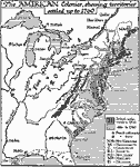 |
The American Colonies, 1760, 1760 A map of the American colonies in 1760. |
 |
North America in 1763, 1763 A map showing North America as adjusted by the Peace of 1763. |
 |
Burgoyne's Campaign, 1777 A map showing the region of Burgoyne's campaign in 1777 during the Revolutionary War. |
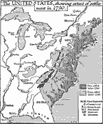 |
The United States in 1790, 1790 A map of the United States, showing the extent of settlement in 1790. |
 |
United States and Canada 1810, 1810 Map of the United States and Canada in 1810. |
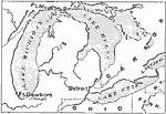 |
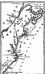
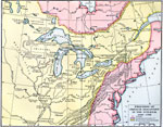
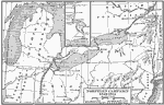
The Great Lakes, 1812 A map showing Lake Michigan, Lake Heron, Lake Erie, and part of Lake Ontario around the outbreak of the War of 1812. |
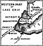 |
Western° Part of Lake Erie, 1812 Map of the Western Part of Lake Erie in 1812. |
 |
Seat of the Creek War, 1812 Map of the Seat of the Creek War in 1813. |
 |
Northern Campaign 1812-1814, 1812-1814 Northern Campaign 1812-1814 |
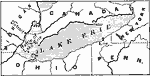 |
Lake Erie, 1813 A map showing the vicinity of Lake Erie, where a naval battle took place during the War of 1812. |
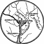 |
Vicinity of Washington, 1814, 1814 Map of the vicinity of Washington, D.C. in 1814. |
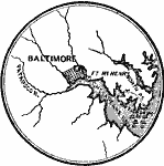 |
Vicinity of Baltimore, 1814, 1814 Map of the vicinity of Baltimore in 1814. |
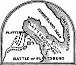 |
Battle of Plattsburg, 1814-1815 Map of the Battle of Plattsburg in 1814-1815. |
 |
United States in 1821, 1821 A map of the United States in 1821, showing the slave and free states. |
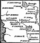 |
Scene of the Seminole War, 1835-1836 Map of the Scene of the Seminole War in 1835. |
 |
Norse America, 1837 A map from Rafn's early work, proposing the pre-Columbian discovery of America by Norse explorers. |
 |
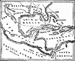
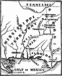
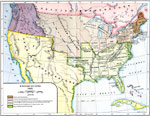
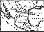
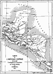
A Map of Western North America, 1845 A map of Mexico; including also Oregon, Texas, and Central America for the year 1845. |
 |
Campaigns in Mexico, 1845-1849 Map of the Campaigns in Mexico in 1845-1849. |
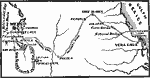 |
General Scott's Campaign in Mexico, 1845-1849 Map of General Scott's Campaign in Mexico in 1847. |
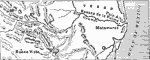 |
Battle of Buena Vista, 1846 A map showing the region around which the Battle of Buena Vista took place. |
 |
Central America and Isthmian Routes, 1846 A map showing Central America and isthmian routes. |
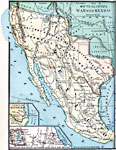 |
War with Mexico, 1846-1848 A map showing the War with Mexico, and the territory acquired from Mexico. |
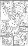 |
Map of the Mexican War, 1846-1848 A map illustrating the Mexican War, and several specific battle sites. |
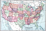 |
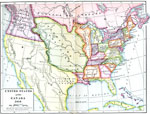
The United States in 1870, 1850 A map of the continental United States in 1870. |
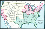 |
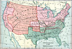
Freedom and Slavery n 1854, 1854 Map showing the areas of freedom and slavery in the United States in 1854. |
 |
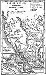
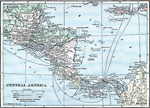
Map of Central America, 1861 A map of Central America from 1861. |
 |
United States in 1861, 1861 A map showing the United States in 1861, showing the Confederacy. |
 |
The West Indies and Mexico, 1898-1906 A map of the West Indies and Mexico. |
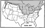 |
Glacial Drift, 1899 Map of showing southern limit of North America's Glacial Drift. |
 |
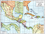
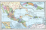
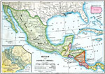
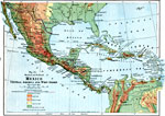
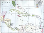
Mexico, Central America and West Indies, 1899 Map of Mexico, Central America and the West Indies in color. |
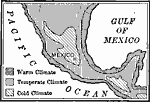 |
Climatic Regions of Mexico, 1899 Map showing climatic regions of Mexico. |
 |
Mexico, Central America and the West Indies, 1901 Map of Mexico, Central America and the West Indies. |
 |
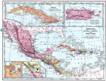
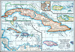
Cuba and Mexico, 1903 A map of Cuba, with inset maps of of Mexico and Havana. |
 |
Eastern North America, 1903 A map of eastern North America in 1903. |
 |
Quebec, 1906 Map of the Quebec in 1906. |
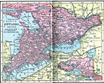 |
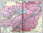
Ontario, 1906 Map of the Ontario in 1906. |
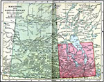 |
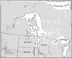
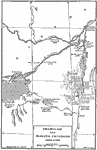
Manitoba and Saskatchewan, 1906 Map of Manitoba and Saskatchewan in 1906. |
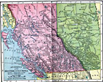 |
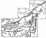
Alberta and British Columbia, 1906 Map of Alberta and British Columbia in 1906. |
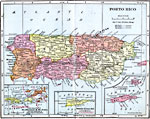 |
Porto Rico, 1906 Map of Puerto Rico in 1906. |
 |
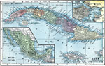
Cuba, Puerto Rico, and Jamaica, 1910 A map of Cuba, Puerto Rico, and Jamaica, with a general map of the West Indies. |
 |
Mexico and Central America, 1910 A map of Mexico and Central America. |
 |
Rainfall on the West Coast, 1910 A map showing the heavy rainfall where the prevailing westerlies blow over the rising coast. |
 |
Nova Scotia and Prince Edward Island, 1911 A map of Nova Scotia and Prince Edward Island. |
 |
Central America, 1916 A physical and political map of Mexico, Central America, and the West Indies. |
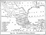 |
Political Divisions of Mexico, 1916 A 1916 map showing the political divisions of Mexico. |
 |
The Panama Canal, 1919 A map showing the Canal Zone showing the complete Panama Canal. |
 |
Central America, 1919 A map of Central America in 1919. |
 |
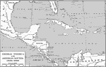
The Caribbean Region, 1919 A map of the Caribbean Region, showing the protectorates of the United States in 1917. |
 |
Vancouver Island, 1919 A map of the region around Vancouver Island. |
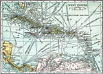 |
West Indies, 1920 West Indies, showing sea routes and submarine cables. |
| Maps > North America > Regional Maps |
Maps is a part of the Educational Technology Clearinghouse
Produced by the Florida Center for Instructional Technology © 2007
College of Education, University of South Florida