| Maps > United States > Civil War |
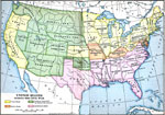 |
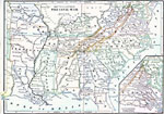
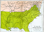
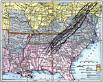
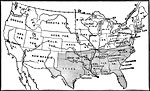
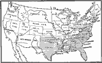
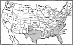
United States during the Civil War, 1861-1865 Map showing the United States during the Civil War. Map is color-coded to differentiate between border, confederate, and union states, and territory controlled by Federal Government. |
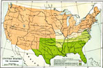 |
The United States Secession, 1861-1865 Map of the United States, subtitled "The Secession." Map is color-coded to show different groups control over the area. |
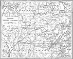 |
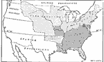
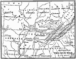
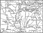
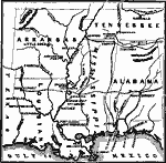
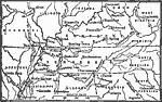
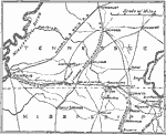
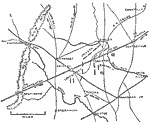
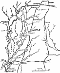
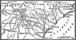
Map of the Theatre of Western Campaigns, Civil War A map showing the Theatre of Western Campaigns in the Civil War. Includes the states of Missouri, Illinois, Indiana, Ohio, Kentucky, Arkansas, Tennessee, Mississippi, Alabama, Georgia, and North Carolina. |
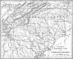 |
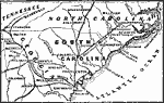
Map of the Theatre of Georgia and Carolinas Campaigns, Civil War A map showing the Theatre of Georgia and the Carolinas Campaigns, including Kentucky, Virginia, Tennessee, North Carolina, South Carolina and Georgia. |
 |
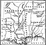
Map of Theatre of Southwestern Campaigns, Civil War A map showing the theatre of southwestern campaigns in the Civil War. Includes Arkansas, Louisiana, Mississippi, Alabama, and Florida. |
 |
The Civil War, 1861-1865 AD Map to illustrate the Civil War. |
 |
Slave and Free Areas after the Missouri Compromise, 1815-1825 Map showing slave and free areas after the Missouri Compromise. |
 |
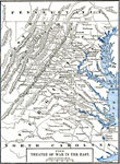
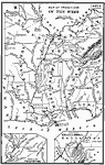
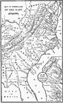
Theatre of War in the United States, 1861-1865 This map shows the Theatre of the Civil War in the United States. Map is color coded to show C.S.A. boundary. |
 |
Progress of Emancipation, 1850-1865 A map showing the progress of emancipation between 1850 and 1865. |
 |
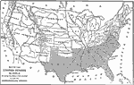
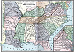
The Civil War in the United States, 1860 Map showing the Civil War in the United States. Map is color-coded to distinguish between Confederate and Federal control over the area. |
 |
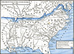
Map of the United States, 1860 "Map of the United States in 1860 showing the states that seceded to form the Confederate States."— A Bird's-Eye View of our Civil War, 1897 |
 |
The Civil War in the West, 1860 Map showing The Civil War in the West. |
 |
The War in the East, 1860 Map showing The Civil War in the West. |
 |
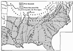
Defenses of the South, 1860-1865 A map showing the South's first line of defenses. |
 |
Southward Movement of Confederate Defenses, 1860-1865 A map showing the gradual southward movements of Confederate defenses. |
 |
Secession of the South, 1861 A map showing the states which first seceded, and those which followed at the outbreak of the Civil War. |
 |
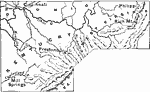
Side Campaign in Missouri, 1861 A map showing site of the side campaign in Missouri. |
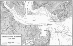 |
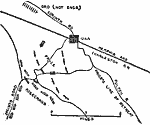
Charleston Harbor, 1861 A map of Charleston Harbor in April of 1861. |
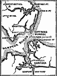 |
Vicinity of Fortress Monroe, 1861 Map of the vicinity of Fortress Monroe in 1861. |
 |
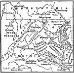
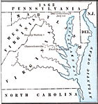
Campaign in Western Virginia, 1861 Map of the Campaign in Western Virginia in 1861. |
 |
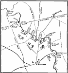
The Battle of Bull Run, 1861 Map of The Battle of Bull Run in 1861. |
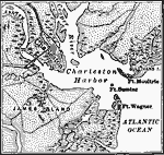 |
Charleston Harbor, 1861 Map showing Charleston Harbor, South Carolina in 1861. |
 |
Territory held by the Confederates at the close of 1861, 1861 Map showing territory held by the Confederates at the close of 1861. |
 |
The War in the West, 1861 Map showing the War in the West of 1861. |
 |
America, 1861 A map of America, showing the states controlled by the Federals and Confederates. |
 |
Movement of Armies, 1861 A map showing the movements of armies in 1861 during the Civil War. |
 |
State Secessions, 1861 State boundaries, conflicts and other political facts regarding 1861 secessions. |
 |
Battle of Bull Run, June 21, 1861 Bull Run, the Field of Strategy. |
 |
Bull Run, Battle of the Forenoon, June 21, 1861 Bull Run, Battle of the Forenoon. |
 |
Bull Run, Battle of the Afternoon, June 21, 1861 Bull Run , Battle of the Afternoon. |
 |
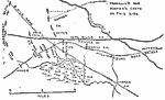
Map of the First Battle of Bull Run, July 21, 1861 A map showing the First Battle of Bull Run on July 21, 1861. The battle took place near the town of Manassas, Virginia, and is also known as the First Battle of Manassas. |
 |
Kentucky and West Virginia, 1861-1865 A map showing Kentucky and West Virginia, where some early battles were fought. |
 |
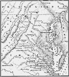
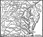
Theatre of War in the East, 1861-1865 This map shows the theatre of war in the east during the American Civil War. |
 |
Civil War, 1861-1865 A map to illustrate the Civil War. |
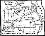 |
Campaigns in Missouri, 1861-1865 A map showing the Campaigns in Missouri. |
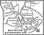 |
Red River Expedition, 1861-1865 A map detailing the Red River Expedition during the Civil War. |
 |
Civil War, 1861-1865 A map with sections showing various regions of the Civil War. |
 |
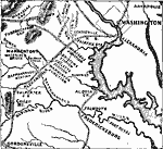
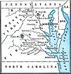
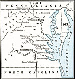
Washington and Surroundings, 1861-1865 A map of Washington D.C. and the surroundings area during the Civil War. |
 |
Seat of War in the West, 1861-1865 A map showing the seat of the Civil War in the West. |
 |
Seat of War in the South, 1861-1865 A map showing the seat of the Civil War in the South. |
 |
Neighborhood of Richmond, 1861-1865 A map of the vicinity around Richmond during the Civil War. |
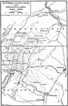 |
Central Maryland and Pennsylvania, 1861-1865 A map of central Maryland and Pennsylvania during the Civil War. |
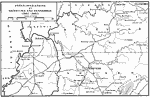 |
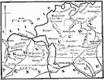
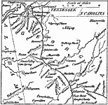
Field Operations in Kentucky and Tennessee, 1861-1865 A map showing field operations in Kentucky and Tennessee during the Civil War. |
 |
Grant Moves Towards Corinth, 1862 A map showing the region where General Grant advanced towards Corinth. Corinth is at the junction of two railroads which made it strategically important to the Confederacy during the Civil War. |
 |
Map of the Battle of Fair Oaks, 1862 A map showing the battle of Fair Oaks, Virginia, which took place on May 31-June 1, 1862. |
 |
Map of the Battle of Seven Days, 1862 A map showing the battle of Seven Days near Richmond, Virginia. The battle took place June 26-July 2, 1862. |
 |
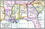
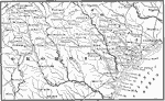
The War in the South and Southwest, 1862 Map of The War in the South and Southwest in 1862. |
 |
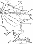
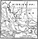
From New Orleans to the Gulf, 1862 Map of the area from New Orleans to the Gulf of Mexico in 1862. |
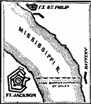 |
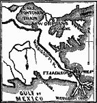
Forts Jackson and St. Philip, 1862 Map of the area of Forts Jackson and St. Philip, around the Mississippi River, in 1862. |
 |
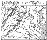
North Virginia - Shenandoah Valley, 1862 Map of the North Virginia - Shenandoah Valley area in 1862. |
 |
McClellan 's Campaign against Richmond, 1862 Map of McClellan 's Campaign against the Richmond area in 1862. |
 |
Pope's Retreat against Washington, 1862 Map of Pope's Retreat against Washington D.C. in 1862. |
 |
Vicinity of Charleston, 1862 Map of the vicinity of Charleston, Virginia in 1862. |
 |
Territory held by the Confederates at the close of 1862, 1862 Map showing territory held by the Confederates at the close of 1862. |
 |
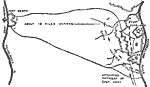
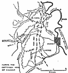
Campaigns around Perryville, 1862 A map showing the campaign around Perryville. |
 |
State Secessions, 1862 State boundaries, conflicts and other political facts regarding 1862 secessions. |
 |
Confederate Line, 1862 The Confederate Line from Columbus to Bowling Green. |
 |
Memphis to Iuka, 1862 Memphis to Iuka, 1862. |
 |
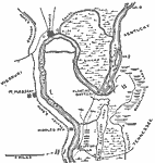
Map of Forts Henry and Donelson, February 1862 A map showing Fort Henry on the Tennessee River and Fort Donelson on the Cumberland River, the sites of an important Civil War battle that led to the first major break in the Confederate line. |
 |
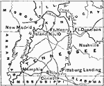
Map of New Madrid and Island No. 10, March 1862 A map showing New Madrid, Missouri, and Island No. 10, the sites of a major Civil War battle. |
 |
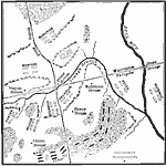
Map of Pea Ridge, March 1862 A map showing the Battle of Pea Ridge, also known as the battle of Elk Horn. The battle took place March 5-8, 1862. |
 |
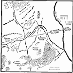
Map of the Battle of Shiloh, April 1862 A map showing the battle of Shiloh, also known as the battle of Pittsburg Landing. The battle took place on April 6 and 7, 1862. |
 |
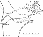
Map of the Battle of Williamsburg, May 1862 A map showing the battle of Williamburg, Virginia, which took place on May 5, 1862. |
 |
Map of Pope's Campaign, August 24, 1862 A map showing Pope's campaign in the Bull Run area on August 24, 1862. |
 |
Map of Pope's Campaign, August 28, 1862 A map showing Pope's campaign in the Bull Run area on the morning of August 28, 1862. |
 |
Map of Pope's Campaign, August 28, 1862 A map showing Pope's campaign in the Bull Run area at Noon, August 29, 1862. |
 |
Map of Battle of Iuka, September 19, 1862 A map showing the Battle of Iuka, Mississippi on September 19, 1862. |
 |
Map of Battle of Perryville, October 8, October 8, 1862 A map showing the Battle of Perryville, Kentucky, on October 8, 1862. |
 |
The War in the East, 1862-1863 A map showing part of the eastern theatre of the Civil War. |
 |
Map of Memphis to Vicksburg, 1862-1863 Map of the area between Memphis and Vicksburg. |
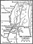 |
The Vicksburg Campaign, 1863 A map showing the area of the Vicksburg campaign during the Civil War. |
 |
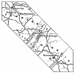
Chattanooga Campaign, 1863 A map of the Chattanooga Campaign in 1863. |
 |
The War in the East, 1863 Map showing the War in the East of 1863. |
 |
Territory held by the Confederates at the close of 1863, 1863 Map showing territory held by the Confederates at the close of 1863. |
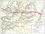 |
Vicksburg Campaign, 1863 A map showing details of the Vicksburg campaign of the Civil War. |
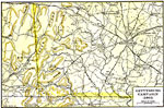 |
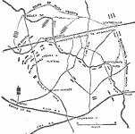
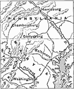
Gettysburg Campaign, 1863 A map of the Gettysburg campaign during the Civil War. |
 |
Positions of Armies, 1863 A map showing the positions and movements of armies, 1863. |
 |
State Secessions, 1863 State boundaries, conflicts and other political facts regarding 1863 secessions. |
 |
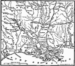
Operation in Louisiana, 1863 Operations in Louisiana, February to July, 1863. |
 |
Campaign Between Nashville and Atlanta, 1863-1864 A map showing the main points of the campaign between Nashville and Atlanta. |
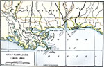 |
Gulf Campaigns of the Civil War, 1863-1865 A map showing the Gulf Campaigns during the Civil War, from 1863 to 1865. |
 |
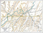
The Vicksburg Campaign, 1864 A map illustrating the operations in the East in 1864. |
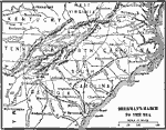 |
Sherman's March to the Sea, 1864 A map showing Sherman's march to the sea. |
 |
Chattanooga to Atlanta, 1864 A map showing the region from Chattanooga to Atlanta |
 |
Valley of Virginia, 1864 A map showing the Valley of Virginia, around which a small campaign was fought in the Civil War. |
 |
War in the Southwest - Red River Expedition, 1864 Map of the War in the Southwest, the Red River Expedition in 1864. |
 |
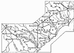
North Carolina, South Carolina, and Georgia - Sherman's March, 1864 Map of General Sherman's March through North Carolina, South Carolina, and Georgia in 1864. |
 |
Territory held by the Confederates, 1864 Map showing territory held by the Confederates at the close of 1864. |
 |
Red River Expedition, 1864 A map showing the battles of the Red River Expedition, 1864. |
 |
Sherman's March to the Sea, 1864 A map showing the route of Sherman's march to the sea. |
 |
State Secessions, 1864 State boundaries, conflicts and other political facts regarding 1864 secessions. |
 |
Atlanta to Savannah, 1864 A map of Athens to Savannah during the Civil War. |
 |
Campaign in the East, 1864-1865 A map showing the region of Sherman's campaign in late 1864 to early 1865. |
 |
Petersburg and Richmond, 1864-1865 Map of Petersburg and Richmond, Virginia in 1864-1865. |
 |
Shenandoah Valley, 1864-1865 Map of Shenandoah Valley area of Virginia in 1864-1865. |
 |
State Secessions, 1865 State boundaries, conflicts and other political facts regarding 1865 secessions. |
 |
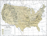
Post Civil War United States, 1865-1892 Political facts, boundaries, and conflicts regarding the post-Civil War reconstruction. |
 |
Map of Operations in the West, 1861 - 1865 Map showing Civil War operations in the West. |
 |
Map of Operations in the East, 1861 - 1865 Map showing Civil War operations in the East. |
| Maps > United States > Civil War |
Maps is a part of the Educational Technology Clearinghouse
Produced by the Florida Center for Instructional Technology © 2007
College of Education, University of South Florida