| Maps > North America > Canada |
 |
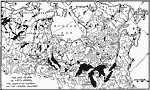
Geology of Canada, A map showing the location of different types of rocks in part of Canada. Chiefly metamorphic and igneous rocks within the heavy lines, chiefly sedimentary rocks without; the Laurentian peneplain is dotted. |
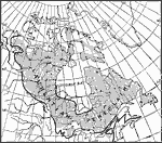
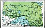
| The Lake Region of North America, A map showing the lake region of North America, the Laurentian Plateau, and the Country Adjacent. |
|
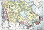 |
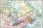
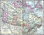
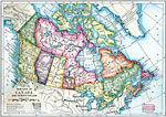
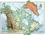
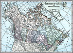
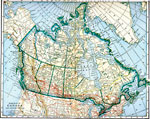
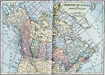
Dominion of Canada and Newfoundland, Map showing Dominion of Canada and Newfoundland. |
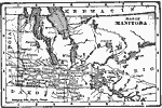 |
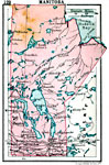
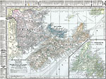
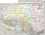
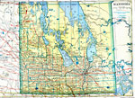
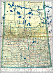
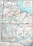
Map of Manitoba, Map of Manitoba. |
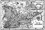 |
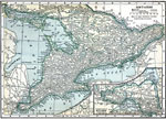
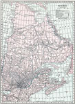
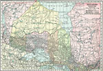
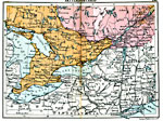
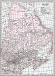
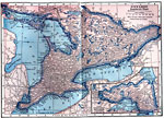
Map of Ontario, Map of Ontario. |
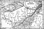 |
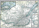
Map of Quebec, Map of Quebec. |
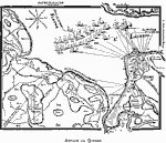 |
Attack on Quebec, Early map of Quebec, Canada. |
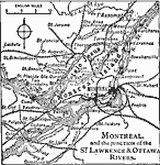 |
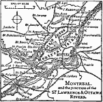
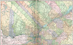
Montreal and the Junction of the St. Lawrence & Ottawa Rivers, Map of Montreal and the Junction of the St. Lawrence & Ottawa Rivers. |
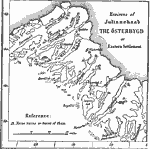 |
Eastern Settlement, 1000 A map showing the environs of Julianehaab, an early Viking settlement in North America. |
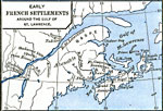 |
Early French Settlements around the gulf of St. Lawrence, 1492-1620 Map shows early French settlements around the gulf of St. Lawrence. |
 |
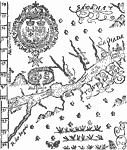
Port St. Louis, 1603-1635 Early map of Canada. |
 |
Tadoussac, 1603-1635 Early map of Canada. |
 |
Quebec, 1613, 1603-1635 Early map of Canada. |
 |
The St. Lawrence, 1609, 1603-1635 Early map of the St. Lawrence area of Canada. |
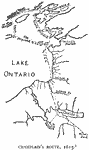 |
Champlain's Route, 1615, 1603-1635 Early map of east coast of Canada. |
 |
Isle de Sainte Croix, 1603-1635 Early map of east coast of Canada. |
 |
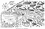
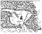
Port Royal, or Annapolis Basin (after Lescarbot), 1603-1635 Early map of east coast of Canada. |
 |
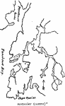
Port Royal (after Champlain), 1603-1635 Early map of east coast of Canada. |
 |
Map of about 1610, 1603-1635 Early map of east coast of Canada. |
 |
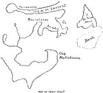
Pentagoet, 1603-1635 Early map of east coast of Canada. |
 |
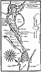
The Site of Montreal, 1609 Early map of Montreal, Quebec, Canada. |
 |
Easterly Portion of Champlain's 1612 Map, 1612 Early map of the eastern side of Canada. |
 |
Part of Champlain's 1613 Map, 1613 Early map of the eastern side of Canada. |
 |
Montreal and its Vicinity, 1665 Early map of Montreal, Quebec, Canada. |
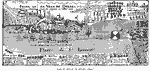 |
Plan of Attack on Quebec, 1690, 1690 Early map of Quebec, Canada. |
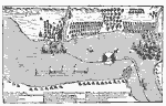 |
Attack on Quebec, 1690, 1690 Early map of Quebec, Canada. |
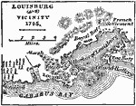 |
Louisburg and Vicinity, 1745 Louisburg is on the S.E. side of the island of Cape Breton. It has an excellent harbor, of very deep water, nearly six miles in length, but frozen during winter. |
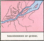 |
Neighborhood of Quebec, 1755-1763 Map shows neighborhood of Quebec, Canada. |
 |
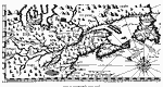
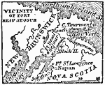
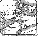
Acadia, 1758 A map showing Acadia, Port Royal, and Louisbourg, and the route by sea between Boston and Quebec. |
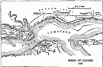 |
Siege of Quebec 1759, 1759 Map of the Siege of Quebec in 1759. |
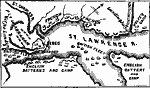 |
Operations around Quebec, 1759, 1759 Map showing military operations around Quebec, 1759. |
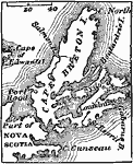 |
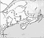
Cape Breton, 1872 Cape Breton, called by the French "Isle Royale", is a very irregularly shaped island, on the S.E. border of the Gulf of St. Lawrence, and separated from Nova Scotia by the narrow channel of Canseau. |
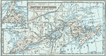 |
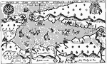
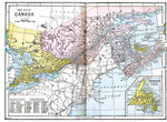
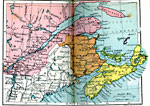
British Provinces in Canada, 1872 British provinces in Canada. Includes a map insert if Newfoundland. |
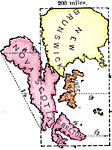 |
Size of Canadian Islands, 1872 Sizes of New Brunswick, Nova Scotia, Prince Edwards Island, and Cape Breton Island. |
 |
Bay Verte, 1872 Bay Verte, or Green Bay, is a western arm of Northumberland Straight; a straight which serparates Prince Edward's Island from New Brunswick and Nova Scotia. |
 |
The Acadian Peninsula, 1881 A map of the Acadian peninsula. |
 |
Canada and Newfoundland, 1883 Physical map of Canada and Newfoundland. Includes railroads. |
 |
Canada, 1885 Canada, with a detail of Newfoundland. |
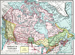 |
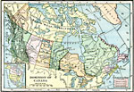
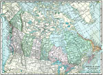
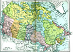
Dominion of Canada, 1899 Map of the Dominion of Canada in color. |
 |
Dominion of Canada, 1901 Map of the Dominion of Canada and Newfoundland. |
 |
Dominion of Canada, 1906 Map of the Dominion of Canada in 1906. |
 |
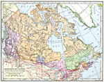
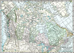
Dominion of Canada, 1906 Physical map of Canada. |
 |
Quebec, 1909 Map of Quebec. |
 |
Ontario, 1909 Map of Ontario. |
 |
Manitoba, 1909 Map of Manitoba. |
 |
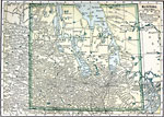
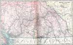
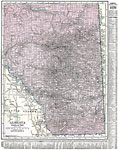
Alberta and Saskatchewan (Southern and Central Portions), 1909 Map of Alberta and Saskatchewan. |
 |
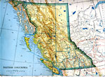
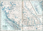
British Columbia, 1909 Map of British Columbia. |
 |
Dominion of Canada and Newfoundland, 1909 Map of Canada and Newfoundland. |
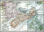 |
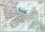
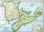
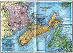
The Maritime Provinces of Canada - New Brunswick, Nova Scotia, Prince Edward Island, 1909 Map of the Maritime Provinces of Canada. |
 |
Dominion of Canada and Newfoundland, 1910 A map of the Dominion of Canada and Newfoundland. |
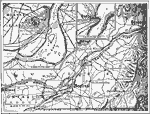 |
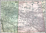
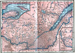
Montreal, Ottawa, and Quebec, 1910 A map showing the location of Montreal, Ottowa, and Quebec. |
 |
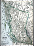
British Columbia, Post World War I Map of British Columbia, Canada. |
 |
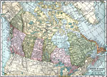
Canada, Newfoundland, and Greenland, 1916 A map of the Dominion of Canada, Newfoundland, and Greenland in 1916. |
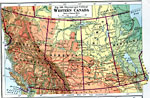 |
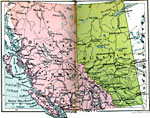
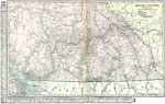
Western Canada, 1916 A physical and political map of western Canada in 1916. |
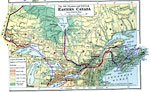 |
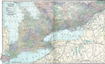
Eastern Canada, 1916 A physical and political map of eastern Canada in 1916. |
 |
Montreal and Vicinity, 1919 A map of Montreal and the junction of the St. Lawrence and Ottawa Rivers. |
 |
Dominion of Canada, 1919 A map showing the Dominion of Canada and Newfoundland in 1919. |
 |
Dominion of Canada and Newfoundland, 1920 Physical map of Canada, Newfoundland, and Greenland. |
 |
Maritime Provinces of Canada, 1920 Physical map of New Brunswick, Nova Scotia, and Prince Edward Island, with inserted map of Newfoundland. Includes railroads and submarine telegraph lines. |
 |
Quebec, 1920 Physical map of Quebec. Includes railroads, canals, and national parks. |
 |
South Central Quebec, 1920 Physical map of the South Central part of Quebec. Includes railroads, canals, and national parks. |
 |
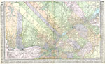
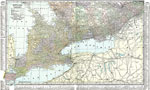
Southern Ontario, 1920 Physical map of the southern part of Ontario. Includes railroads, canals, national parks, and indian reservations. |
 |
Northern Ontario, 1920 Physical map of the northern part of Ontario. Includes national parks, forest reservations, and indian reservations. |
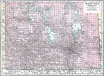 |
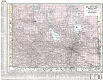
Southern Manitoba, 1920 Physical map of the southern part of Manitoba. |
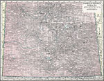 |
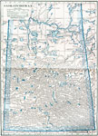
Southern Saskatchewan, 1920 Physical map of the southern part of Saskatchewan. |
 |
Southern Alberta, 1920 Physical map of the southern part of Alberta. |
 |
Southern British Columbia, 1920 Physical map of the southern part of British Columbia. Includes railroads and national parks. |
 |
Dominion of Canada and Newfoundland, 1920 Dominion of Canada and Newfoundland. |
 |
Maritime Provinces and Quebec, 1920 The maritime provinces of Canada, and Quebec. |
 |
Northern Ontario, 1920 Northern Ontario in Canada. |
 |
Settled Ontario, 1920 The settled region of Ontario. |
 |
Manitoba, 1920 Map of Manitoba. |
 |
British Columbia and Alberta, 1920 British Columbia and Alberta in Canada. |
 |
Saskatchewan, 1920 Saskatchewan in Canada. |
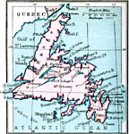 |
Newfoundland, 1920 Map of Newfoundland. |
 |
Dominion of Canada and Newfoundland, 1920 Dominion of Canada and Newfoundland. |
 |
Dominion of Canada and Newfoundland, 1920 Map of Canada and Newfoundland. |
 |
The Maritime Provinces of Canada, 1920 Map of the Maritime Provinces of Canada (New Brunswick, Nova Scotia, Prince Edward Island) with inset map of Newfoundland. |
 |
Quebec, 1920 Map of Quebec. |
 |
Quebec (South Central Part), 1920 Map of Quebec. |
 |
Ontario (Southern Part), 1920 Map of southern part of Ontario. |
 |
Ontario (Northern Part), 1920 Map of northern part of Ontario. |
 |
Manitoba (Southern Part), 1920 Map of southern part of Manitoba. |
 |
Alberta (Southern Part), 1920 Map of southern part of Alberta. |
 |
British Columbia (Southern Part), 1920 Map of southern part of British Columbia. |
 |
Dominion of Canada and Newfoundland, Post World War I Map of Dominion of Canada and Newfoundland. |
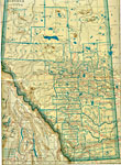 |
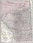
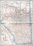
Alberta, Post World War I Map of Alberta, Canada. |
 |
Manitoba, Post World War I Map of Manitoba, Canada. |
 |
The Maritime Provinces, Post World War I Map of Canada's Maritime Provinces. |
 |
Saskatchewan, Post World War I Map of Saskatchewan, Canada. |
 |
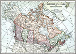
Dominion of Canada and Newfoundland, 1922 Canada and Newfoundland with providences. |
 |
Maritime Provinces of Canada, 1922 Canadian provinces along the Atlantic Ocean. Includes railroad routes. |
 |
Quebec, 1922 Quebec with main map of the southern part and inserts of northern and western parts |
 |
Ontario, 1922 Southern Ontario in the main map and the lower west part is in the insert. Includes railroads. |
 |
Manitoba, 1922 Map of Manitoba with railroad routes. |
 |
Saskatchewan, 1922 Map of Saskatchewan with railroad routes. |
 |
Alberta, 1922 Map of Alberta with railroad routes. |
 |
British Columbia, 1922 Map of British Columbia. |
| Maps > North America > Canada |
Maps is a part of the Educational Technology Clearinghouse
Produced by the Florida Center for Instructional Technology © 2007
College of Education, University of South Florida