| Maps > United States > Growth of Nation |
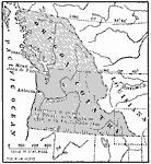 |
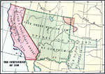
The Oregon Country, 1830s to 1840s Map showing the Oregon Country. |
 |
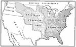
Map showing the Territorial Growth of the United States, Early 1800s Map showing the territorial growth of the United States. |
 |
Original Territory of the United States, Treaty of 1832 Map of the Original Territory of the United States - Treaty of 1832. |
 |
Territorial Growth of the United States, 1897 Map of the Territorial Growth of the United States. |
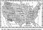 |
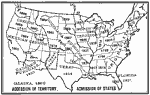
How United States Obtained its Territory, 1910 Map to show when and how the United States obtained its territory. |
 |
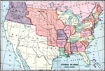
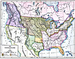
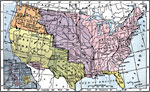
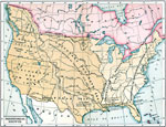
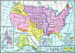
Expansion of the United States, 1783 - 1853 Map showing expansion of the United States . Map is color-coded to show different sections of expansion. |
 |
Territorial Development of the United States, 1830-1870 AD Maps to illustrate the territorial development of the United States. |
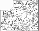 |
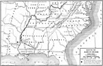
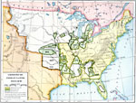
Campaigns in Kentucky and Tennessee, 1812-1814 A map showing the campaigns in Kentucky, Tennessee, etc. |
 |
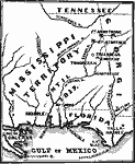
The United States Before the Louisiana Purchase, 1800 A map showing the United States before the Louisiana Purchase. |
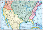 |
Claims in North America, 1760 A map showing the claims of French, England, and Spain upon the central part of North America in 1760. |
 |
Old Claims in the United States, 1763 A map showing the present territory of the United States, and parts claimed by European nations before 1763. |
 |
The Growth of the United States, 1776-1867 Map showing growth of the United States from 1776-1861. Inset map of Alaska. |
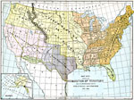 |
Acquisition of Territory, 1776-1884 United States acquisition of territory and its distribution among political divisions between 1776 and 1884. |
 |
Map showing the Territory of the United States before and after the Louisiana Purchase, 1779-1780 Map showing the Territory of the United States before and after the Louisiana Purchase. |
 |
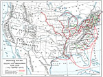
Acquisitions of US Territory, 1783-1853 A map showing US territorial expansion from 1783 to 1853. |
 |
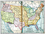
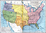
The United States of America, 1783-1853 A map of the continental United States. |
 |
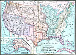
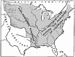
Territorial Growth of the United States 1783 to 1867, 1783 to 1867 This is a complete map of the United States showing the growth of territory from 1783 to 1867. This includes the large addition made by the Louisiana Purchase in 1803. It shows all of the major political boundaries of the time, including the United States, Spanish Cession, Mexican Cession, Texas Cession, Oregon Country by discovery exploration and treaty with Great Britain and the Northwest Territory. — Foster, 1921 |
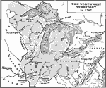 |
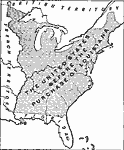
The Northwest Territory, 1787 A map showing the Northwest Territory in 1787. |
 |
The Northwest Territory, 1787 A map showing the Northwest Territory. |
 |
United States, 1789 A map of the United States as it was in 1789, showing states, territories, British possessions, and Spanish possessions. |
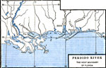 |
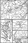
Perdido River - The West Boundary of Florida, 1790-1842 One of four maps (on top half of this page) illustrating the War of 1812. |
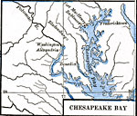 |
Chesapeake Bay, 1790-1842 One of four maps (on top half of this page) illustrating the War of 1812. |
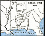 |
Creek War, 1813 Map illustrating the Creek War. |
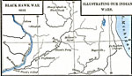 |
Black Hawk War, 1832 One of four maps (on bottom half of this page) illustrating our Indian Wars. |
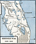 |
Seminole War, 1835-1842 One of four maps (on bottom half of this page) illustrating our Indian Wars. |
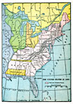 |
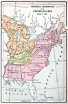
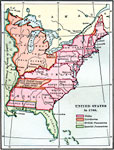
The United States, 1800 Map showing the United States in 1800. Map is color-coded to show the thirteen original states. |
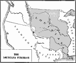 |
Louisiana Purchase, 1803 A map showing the Louisiana Purchase from France in 1803. |
 |
The Expansion Resulting from the Louisiana Purchase, 1803 Map showing the expansion of the United States resulting from the Louisiana Purchase. |
 |
The United States after the Louisiana Purchase, 1803 A map showing the United States after the Louisiana Purchase in 1803. |
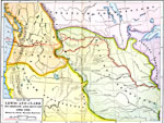 |
Route of Lewis and Clark, 1803-1806 A map showing the route of the Lewis and Clark expedition to Oregon and return. |
 |
The Louisiana Purchase, 1803-1809 A map showing the Louisiana Purchase, 1803-1809. |
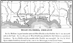 |
West Florida, 1803-1819 In 1810 Madison by proclamation annexed West Florida to the Perdido; but it was occupied only to the Pearl. In 1812 this part of West Florida was admitted to the Union as a portion of Louisiana. |
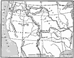 |
Western Explorations, 1804-1806 Map showing the Western Explorations of the United States from 1804-1806. |
 |
Route of Aaron Burr, 1806-1807 A map showing the route of Aaron Burr, from 1806 to 1807. |
 |
Seat of the Creek War, 1813 AD Map of the Seat of the Creek War in 1813. |
 |
War of 1812, 1812 A series of maps showing the territory of active operations in the War of 1812. |
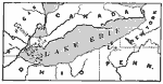 |
Where the Battle of Lake Erie was Fought, 1812 Map showing where the Battle of Lake Erie was fought. |
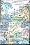 |
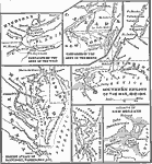
The War of 1812, 1812-1814 Map sections showing various regions of the War of 1812, as well as the conflict with the Native Americans (1790 and 1811). |
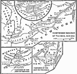 |
Northern Region of the War of 1812, 1812-1814 A map showing the northern, central, and western regions of the war, 1812-1814. |
 |
Southern Region of the War of 1812, 1812-1814 A map showing the southern region of the war of 1812. |
 |
Map of the Southwestern Operations, 1813-1815 A map of Southwestern operations during the war of 1813-1815 with Britain. |
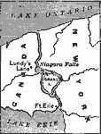 |
Niagara Falls, 1814 A map showing Niagara Falls, and a battle site (Lundy's Lane). |
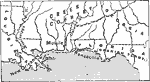 |
Battle of New Orleans, January 8, 1815 A map showing the southern States, and where the Battle of New Orleans was fought. |
 |
Cession of Native Lands, 1816-1830 A map showing the cession of Native American lands from 1816 to 1830. |
 |
Treaty with Spain, 1819 A map showing the treaty with Spain in 1819. |
 |
Missouri Compromise, 1820 AD A map showing the free and slave territory as fixed by Missouri Compromise. |
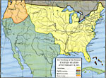 |
The Territory of the Present United States, After February 19, 1821 Map shows the territory of the (then) present United States after February 19, 1821. Map is color-coded to distinguish various countries' claims to United States. |
 |
The result of the Missouri Compromise, 1821 Map showing the United States in 1821, listing capitals of states and territories. |
 |
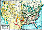
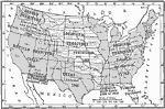
The United States, 1840 Map showing the United States in 1840, listing states' date of admission to the Union. |
 |
The United States, 1850 Map showing the United States in 1850, listing states' date of admission to the Union. |
 |
New States Admitted, 1791 - 1821 A map showing the States admitted before 1821. |
 |
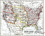
United States, 1825-1830 A map showing the United States as it was in 1825 to 1830. |
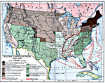 |
Slavery and the Slave Trade, 1830-1850 A map showing slavery and the slave trade in the United States, from 1830-1850. |
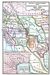 |
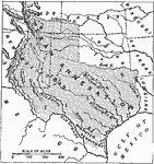
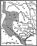
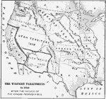
Texas Controversy, 1836-1850 A map showing the Texas Controversy, with an inset of Spanish Texas. |
 |
War With Mexico, 1840 A map showing the routes of United States troops in the war with Mexico. |
 |
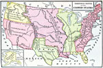
The United States, 1840 A map showing the United States as it was in 1840. |
 |
Trade and Migration, 1840-1850 A map showing the principal routes of trade and migration from 1840-1850. |
 |
The Santa Fe and Oregon trails to the Pacific Coast, 1840-1850 Map showing the Santa Fe and Oregon trails to the Pacific Coast. |
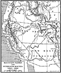 |
Overland Routes in the West, 1841-1850 A map showing mountain passes and overland routes in the West, 1841-1850. |
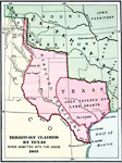 |
Territory claimed by Texas, 1845 Territory claimed by Texas when admitted into the Union, 1845. |
 |
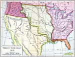
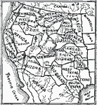
The Oregon Country, 1845 Map showing the Oregon Country in about 1845. |
 |
Texas Annexation, 1845 A map showing the territory annexed with Texas, 1845. |
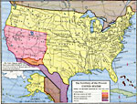 |
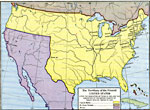
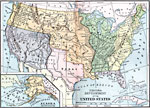
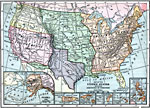
The Territory of the Present United States, 1845-1886 This map shows territory of the U.S. after the annexation of Mexican cessions in 1848 and 1853. Map is color coded to show areas belonging to British Dominions, Mexico, and the U.S. Inset map of Alaska bought from Russia in 1868. |
 |
Dispute Between United States and Mexico, 1846 A map showing the territory in dispute between the United States and Mexico. |
 |
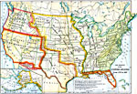
The Territory of the Present United States, 1846-1848 Map is color coded to show areas belonging to Great Britain, Mexico, and the U.S. It shows the territory of the United States after the annexation of Texas in 1845, and the acquisition of the Oregon country by treaty with Great Britain in 1846. |
 |
Territory Acquired from Mexico, 1848 A map showing territory acquired from Mexico. |
 |
Territory ceded by Mexico, 1848-1853 A map showing the territory ceded by Mexico to the United States in 1848 and 1853. |
 |
Freedom and Slavery, 1820 A map showing areas of freedom and slavery as established by the Missouri compromise of 1820. |
 |
Compromise of 1850, 1850 A map showing the Compromise of 1850. |
 |
Results upon slavery of the Compromise of 1850, 1850 Map showing the results upon slavery of the Compromise of 1850. |
 |
Compromise of 1850, 1850 An 1850 map of slave and free states after the Compromise of 1850. |
 |
United States Acquisition of Territory, 1853 A map showing the acquisition of territory by the United States. |
 |
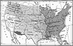
Test-vote on the Kansas-Nebraska Bill, 1854 A map showing the results of the test-vote on the Kansas-Nebraska Bill in the House of Representatives. |
 |
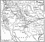
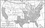
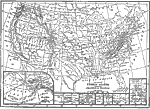
The Western Territories in 1854 after the passage of the Kansas-Nebraska Bill, 1854 Map showing the Western Territories in 1854 after the passage of the Kansas-Nebraska Bill. |
 |
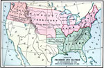
The United States, 1861 Map showing the United States in 1861, listing states' date of admission to the Union. |
 |
Map Showing the Louisiana Purchase, 1865-1898 Map showing the Louisiana Purchase. |
 |
Map Showing Present Boundaries in Dotted Lines, Proposed New Ones in Black Lines, 1865-1898 Map showing the Present Boundaries in Dotted Lines, Proposed New Ones in Black Lines. |
 |
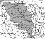
Territorial Development of the United States, 1867 A map showing the territorial development of the United States. |
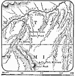 |
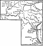
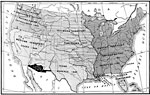
Sioux War, 1876 A map showing the scene of the Sioux War, 1876. |
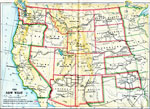 |
The New West, 1885-1909 Map showing growth of the United States into the New West. |
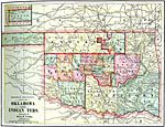 |
Railroad and County Map of Oklahoma and Indian Territories, 1892 Railroad and county map of Oklahoma and Indian Territories. |
 |
Map of the Louisiana Purchase, 1803 Map of the Louisiana Purchase. |
 |
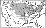
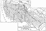
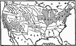
Map Showing the Territorial Growth of the United States, 1894 Map showing the territorial growth of the United States as it expanded westward. |
 |
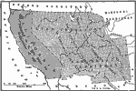
Territorial Growth of the United States, 1897 This is a map showing the territorial growth of the United States into the west. |
 |
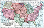
Accession of Territory. Admission of States., 1899 Map of United States showing dates each state was admitted to the Union. |
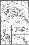 |
Territories of the United States, 1900 Territories added to the United States, Alaska, Hawaii, Puerto Rico, and the Philippines. |
 |
Territorial Acquisitions of the United States, 1900 A map showing United States territorial acquisitions, including former possessions such as the Philippines. |
 |
Expansion Map of the United States, 1904 Map shows territories and dates purchased. |
 |
Expansion Map of the United States, 1904 A 1904 map showing the territorial expansions of the United States. |
 |
Territorial Growth of the United States, 1907 A map showing the territorial growth of the United States. |
 |
Map of the United States Showing Acquisition of Territory, 1909 AD Map shows the westward expansion of the United States. |
 |
US Territorial Acquisitions, 1910 A map to show when and how the United States obtained its territory. |
 |
United States, Political Acquisitions, 1911 This map illustrates the various divisions of political acquisition of the United States and the dates of their respective occurrences. |
 |
Territorial Growth of the United States, 1911 |
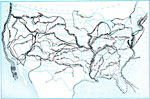 |
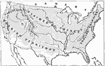
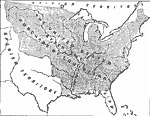
Westward March of the Great Pioneers and Explorers, 1911 Map shows land routes taken by famous explorers across North America. |
 |
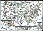
Map of the United States Showing Aquisition of Territory, 1912 Map of the United States and its territories showing the date of aquisition of each state or territory. Also shows major cities, waterways, and mountain ranges. Includes insert maps of the territories of Alaska, Porto Rico, Samoa Islands, Manua, Wake Island, Guam Island, Hawaiian Islands, and Philippine Islands. |
 |
Territorial Gains of the United States, 1919 A map showing the territorial gains of the United States up to 1919. |
 |
Acquisition of Territory by the United States, 1922 Provides territories acquired by the United States. Includes the year and method of acquisition. |
| Maps > United States > Growth of Nation |
Maps is a part of the Educational Technology Clearinghouse
Produced by the Florida Center for Instructional Technology © 2007
College of Education, University of South Florida