| Maps > Globes & Multi-Continent > Complete Maps |
 |
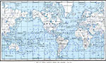
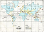
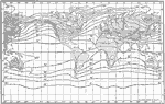
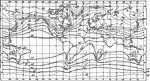
Map of Ocean Currents, Map of Ocean Currents. |
 |
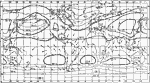
Map of World Showing Winds for January, Map of World showing winds for January. |
 |
Map of World Showing Winds for July, Map of World showing winds for July. |
 |
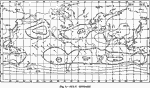
Map Showing Isotherms for January, Map showing isotherms for January. |
 |
Map Showing Isotherms for July, Map showing isotherms for July. |
 |
Rainfall Map of the World - Mollweide's Projection, Map showing rainfall of the world - Mollweide's Projection. |
 |
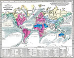
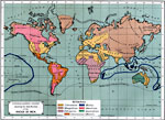
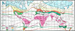
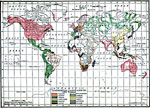
Map Showing Vegetation Regions, Map showing vegetation regions of the world. |
 |
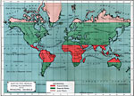
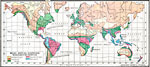
, Map showing density of population in various regions of the world. |
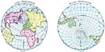 |
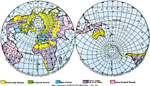
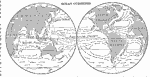
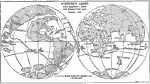
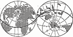
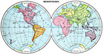
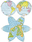
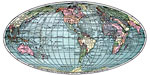
The Hemispheres, Map showing the land and water hemispheres of the world. |
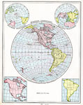 |
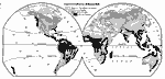
Western Hemisphere, Map showing the western hemisphere. |
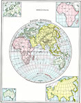 |
Eastern Hemisphere, Map showing the eastern hemisphere. |
 |
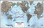
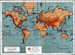
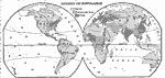
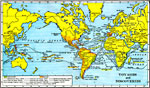
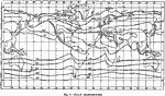
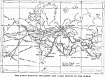
A Map of the World showing Ocean Routes, Map showing ocean routes of the world. |
 |
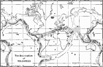
Map of the World showing the distribution of Volcanoes and Earthquakes, Map of the World showing the distribution of Volcanoes and Earthquakes. |
 |
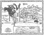
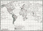
Map of the World showing the principal Ocean Currents & boundaries of River Systems, Map of the World showing the principal Ocean Currents & boundaries of River Systems. |
 |
Map of the World illustrating the Principal Features of Meteorology, Map of the World illustrating the Principal Features of Meteorology. |
 |
Map of the World illustrating the relative amount of Rain or Melted Snow and Ice deposited on the Lands, Map of the World illustrating the relative amount of Rain or Melted Snow and Ice deposited on the Lands. |
 |
Map of the World showing the Distribution and Limits of Cultivation of Primitive Plants useful to Mankind, Map of the World showing the Distribution and Limits of Cultivation of Primitive Plants useful to Mankind. |
 |
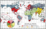
Map of the World showing the distribution of the Principal Races and Varieties of Mankind, Map of the World showing the distribution of the Principal Races and Varieties of Mankind. |
 |
Map of the World illustrating the Productive Industry of Various Countries, Map of the World illustrating the Productive Industry of Various Countries. Map also exhibits the principal features of Commerce and Navigation. |
 |
The Zones, Map of the Western and Eastern Hemispheres. |
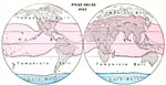 |
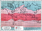
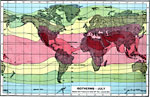
Heat Belts- July, Map of world heat belts in July. |
 |
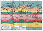
Heat Belts- January, Map of world heat belts in January. |
 |
Heat Changes During the Year, Map of heat changes during the year. |
 |
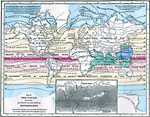
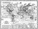
Winds and Rainfall, World winds and rainfall. |
 |
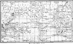
Ocean Currents, World ocean currents. |
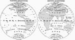 |
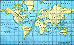
Western Hemisphere, Eastern Hemisphere, Map of both the Eastern and Western hemispheres. |
 |
, Map showing continents, islands, and oceans. |
 |
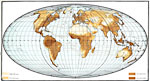
Relief Map of the World - Mollweide's Projection, Map showing continents, islands, and oceans. |
 |
The World as known to Europe about the year 1418, 1418 Map of the world as known to Europe about the year 1418. |
 |
Known World at the Time of Columbus, 1492 A map showing the part of the world known to Europeans when Columbus sailed shown in white. |
 |
Chief Voyages of Exploration, 1492-1522 A map of the world, showing the chief voyages of exploration up to 1522. |
 |
Columbus, Magellan, and De Gama, 1492-1522 A map showing how Columbus found America in trying to get to Asia. It also shows the voyages of De Gama and Magellan. |
 |
Schoner's Globe, 1523 An illustration of Schroner's Globe, with Magellan's Route and Demarcation Line shown. |
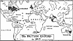 |
The British Empire, 1815, 1815 A map of the British Empire in 1815. |
 |
Map of the World illustrating the principal features of The Land and the Co-Tidal Lines, 1855 Map of the World illustrating the principal features of The Land and the Co-Tidal Lines. |
 |
Thermal and Tidal Chart, 1873 Map of the World showing ocean tides and temperature ranges. |
 |
The World as known in our own day, 1884 Map of the world as known to Europe in about the year 1884. |
 |
Magnetic Declination and Inclination, 1885 Lines of Equal Magnetic Declination and Inclination. |
 |
Volcanoes, 1885 Chart of Volcanoes, Active and Extinct. |
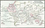 |
England and Her Dependencies, 1889 A map of England and her dependencies in 1889. |
 |
Map of the World Showing the Distribution of Volcanoes and Region of Earthquakes, 1891 Map showing the Earth's volcanoes and earthquakes. |
 |
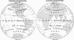
Land and Water Hemispheres, 1891 Map showing the Earth's land and water hemispheres. |
 |
Hydrographical Map showing the Oceanic Areas & River Systems of the Earth, 1891 Map showing the Earth's oceanic areas and river systems. |
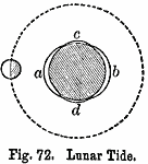 |
Lunar Tide, 1891 Map showing Lunar Tide. |
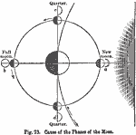 |
Cause of the Phases of the Moon, 1891 Map showing cause of the phases of the Moon. |
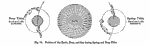 |
Position of the Earth, Moon, and Sun during Spring and Neap Tide, 1891 Map showing position of the Earth, Moon, and Sun during Spring and Neap Tide. |
 |
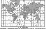
Co-Tidal Chart, 1891 Map showing progress of the tidal wave in each of the oceans. |
 |
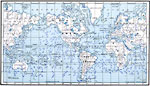
Map of the World showing the direction of the Ocean Currents, 1891 Map showing the direction of the Earth's ocean currents. |
 |
Map of the World showing the Isothermal Lines and the boundaries of the Physical Zones, 1891 Map showing the Isothermal Lines and the boundaries of the Physical Zones. |
 |
Map of the World showing the distribution of the Wind & Rain together witb Ocean Routes., 1891 Map showing the direction of the Earth's ocean currents. |
 |
Declination Chart, 1891 Map showing the declination of the Eastern and Western hemispheres. |
 |
Map of the World showing the distribution of Vegetation according to the Zones of Physical Climate, 1891 Map showing the distribution of Vegetation according to the Zones of Physical Climate. |
 |
Map of the World showing the distribution of its Principal Animals, 1891 Map showing the distribution of its Principal Animals. |
 |
Ethnographic Chart showing the distribution of the Races of Men, 1891 Ethnographic Chart showing the distribution of the Races of Men. |
 |
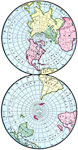
Hemispheres, 1899 Map of Eastern and Western Hemispheres in color. |
 |
Land Surface Characteristics and Ocean Currents, 1899 Map of Earth's Land Surface Characteristics in color. Coded to show deserts, forests, and arctic regions. |
 |
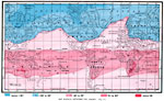
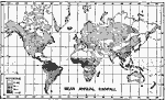
Climate, Mean Annual Isotherms, 1899 Map of Earth's Climate, Mean Annual Isotherms in color. Coded to show temperature levels of various regions. |
 |
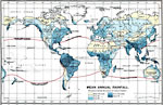
Mean Annual Rainfall with Limits of Snowfall, 1899 Map of Earth's Mean Annual Rainfall with Limits of Snowfall in color. Coded to show precipitation amounts of various regions. |
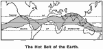 |
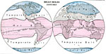
Hot Belt of the Earth, 1899 Map of Earth's "Hot Belt" around the equator. |
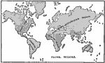 |
Faunal Regions, 1899 Map of Earth's Faunal Regions. |
 |
Places of Origins of Plants., 1899 Map illustrates Places of Origins of Plants. |
 |
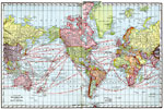
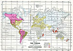
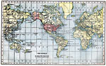
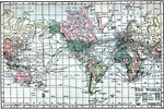
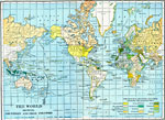
The World, 1901 Map of the world, showing colonial possessions, principal commercial routes, and telegraph lines. |
 |
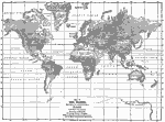
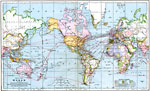
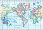
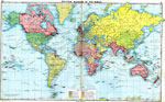
Map of the World, 1901 Map of the World. |
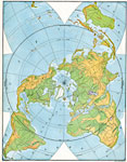 |
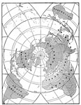
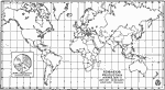
World- Polar Perspective, 1901 A map of the world from the perspective of the North Pole. |
 |
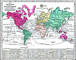
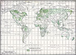
World Vegetation Regions, 1901 Map showing vegetation regions of the world. |
 |
Life Regions, 1901 Life regions of the world. |
 |
World Density of Population, 1901 Map of world population density. |
 |
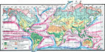
Known World 500-1900, 1901 Map showing the known regions of the world over at various points in time. |
 |
The World on Mercator's Projection, 1903 A Mercator's Projection map of the world in 1903. |
 |
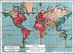
The World in 1906, 1906 A map showing the political divisions of the world in 1906. |
 |
The World on Mercator's Projection, 1906 Map of the world in 1906. |
 |
The World on Mercator's Projection, 1906 Map of the world in 1906. |
 |
The World on Mercator's Projection, 1906 Map of the world in 1906. |
 |
State Organizations, 1909 This map shows the governmental organizations of the countries of the world; monarchies, republics, colonies, or protectorates. |
 |
Commercial Languages of the World, 1909 This map shows the languages that are spoken in various countries of the world. |
 |
Timber Supply, 1909 This map shows the primary and secondary sources of timber throughout the world. |
 |
Average World Tobacco Production, 1909-13, 1909-1913 A map showing centers of production of tobacco across the world. |
 |
The World, 1910 The world on Mercator's Projection. |
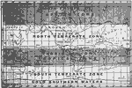 |
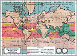
A Map of the Zones, 1910 A map of the climate zones. |
 |
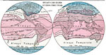
Wind Belts of Earth, 1910 A map showing the principal wind belts of the earth. |
 |
Mean Annual Rainfall in the World, 1910 A map showing the mean annual rainfall of the world. |
 |
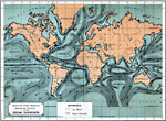
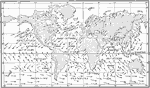
Currents and Drifts of the Oceans, 1910 A chart showing the principal ocean currents and ocean drifts of the world. |
 |
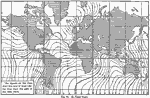
Isothermal Chart of the World for January, 1910 |
 |
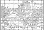
The World, 1910 Map of the world. |
 |
Map of the World on the Equivalent Projection, 1910 This new map presents a comprehensive view of the superficial area of the Earth, not unlike that which would be displayed by the printed cover of a globe, if removed and flattened. |
 |
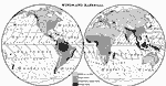
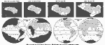
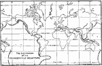
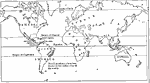
Great Voyages from 1492 to 1580, 1911 Map shows water routes taken by famous explorers. |
 |
Voyages and Discoveries, 1912 Map traces water routes of famous explorers during late 1400's and early 1500's. |
 |
The World, Post World War I Map of The World showing countries and their colonies. |
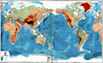 |
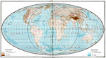
Bathy-Orographical Chart of the World, 1915 A map of the world showing land elevation and water depth. |
 |
Isotherms - July, 1915 A map of the world showing isotherms in July. |
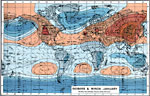 |
Isobars & Winds - January, 1915 A map showing isobars & winds in January. |
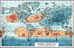 |
Isobars & Winds - July, 1915 A map showing isobars & winds in July. |
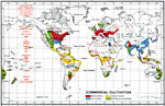 |
Commercial Cultivation, 1915 A map showing commercial cultivation throughout the world. |
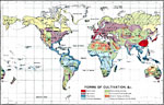 |
Forms of Cultivation, 1915 A map showing forms of cultivation throughout the world. |
 |
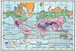
Mean Annual Rainfall, 1915 A map showing mean annual rainfall throughout the world. |
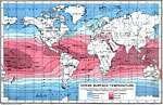 |
Ocean Surface Temperature, 1915 A map showing ocean surface temperature throughout the world. |
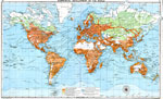 |
Commercial Development of the World, 1915 A map showing commercial development throughout the world. |
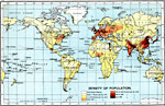 |
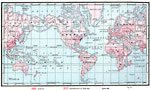
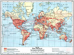
Density of Population, 1915 A map showing density of population throughout the world. |
 |
Races of Mankind, 1915 A map showing races of mankind throughout the world. |
 |
Religions of Mankind, 1915 A map showing religions of mankind throughout the world. |
 |
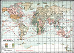
Political Divisions of the World, 1915 A map showing political divisions throughout the world. |
 |
Younger Fold Mountains, 1915 Distribution of the younger fold mountains throughout the world. |
 |
Volcanoes, 1915 Distribution of Volcanoes throughout the world. |
 |
January Isotherms, 1915 World isothermal lines in January. |
 |
July Isotherms, 1915 World isothermal lines in July. |
 |
January Isobars, 1915 World isobars in January. |
 |
July Isobars, 1915 World isobars in July. |
 |
Worldwide Mean Annual Rainfall, 1915 Global mean annual rainfall. |
 |
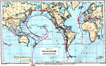
World Transportation Routes, 1915 Railway, steamship and cable routes of the world. |
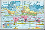 |
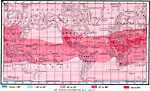
Winds and Temperatures in Janaury, 1916 A 1916 map showing winds and temperatures during the month of January. |
 |
Winds and Temperatures in July, 1916 A 1916 map showing winds and temperatures during the month of July. |
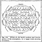 |
Winds on the Earth's Surface, 1916 A map showing the winds on the earth's surface, also a vertical section of the atmosphere showing circulation. |
 |
Prevailing Westerlies and Trade Winds, 1916 A map of the world, showing prevailing westerlies and trade winds. |
 |
Coffee Production in 1916, 1916 A map showing the coffee-producing regions of the world in 1916. |
 |
Ocean Currents, 1916 A map showing the currents of the world's oceans. |
 |
The World, 1916, 1916 A map of the world in 1916, showing principal transportation lines and commercial development. |
 |
Ocean Route Map of the World, 1920 Ocean Route Map of the World in Gall's Stereographic Projection. |
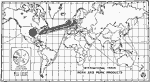 |
International Trade in Pork and Pork Products, 1922 Map showing the international trade of pork and pork products between countries. |
Maps is a part of the Educational Technology Clearinghouse
Produced by the Florida Center for Instructional Technology © 2007
College of Education, University of South Florida