Google Earth is a free program that combines maps and geographic information with satellite and aerial photography. With Google Earth, you can fly over and explore major cities and landmarks around the world. While Google Earth is a standalone program you download and install on your computer, it requires an internet connection because it exchanges information with Google’s search services. Once you zoom in on an area of the globe to display a location in more detail, you can turn on layers that display additional information provided by Google, such as nearby restaurants and other businesses. This information is searchable, and you can use markers to save your searches for later use. You can also use Google Earth to get driving directions between any two points.
Google Earth is an example of a GIS (Geographic Information Systems) application. To be more specific, Google Earth is a GIS viewer. GIS applications use maps to display data according to location.
To get started using Google Earth:
- Download and install Google Earth. The program should run with no problems on any computer built within the last three years, but you can check this page to verify that your computer can run Google Earth.
- Once you have installed the program, take a look at this page to get a brief tour of the features of the program. You can also take a sightseeing tour by clicking on any of the top 10 sites listed on the right side of the page. Each link will open the site in Google Earth when you click on it.
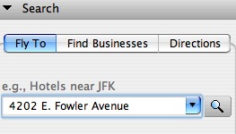
- Use Google Earth to find your home address or the address of your school. The easiest way to do this is by entering the address in the Fly To field and pressing Return or Enter on your keyboard or clicking on the search button.
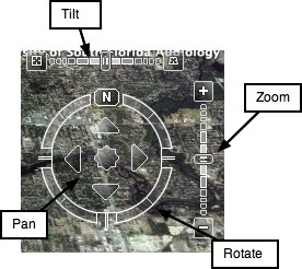
- Google Earth will then zoom in on your location. Use the controls on the right side of the window to change the view (zoom in and out, or change the tilt for a different perspective).
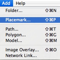
- Add a placemark for your home address (Add > Placemark). Add a few more placemarkers for other places in your community (your church, community center, etc.).
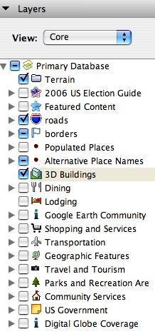
- Once you have found your home, turn on some of the layers. Click the box next to Roads to have the names of the major streets displayed as an overlay, or click on Dining to view placemarkers for restaurants near your home.
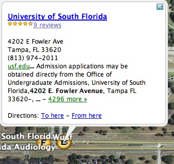
- Search for USF (4202 E. Fowler Avenue, Tampa FL) and add another placemark (Add > Placemark). Click on the placemark and get directions from your home address to USF by clicking on the To here link.
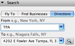
Enter the addresses of your starting and end points.
Google Earth will display the route on the map.
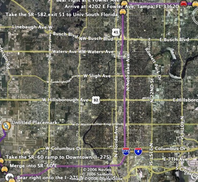
- You can click on the Play button to have Google Earth fly you along the route.
